
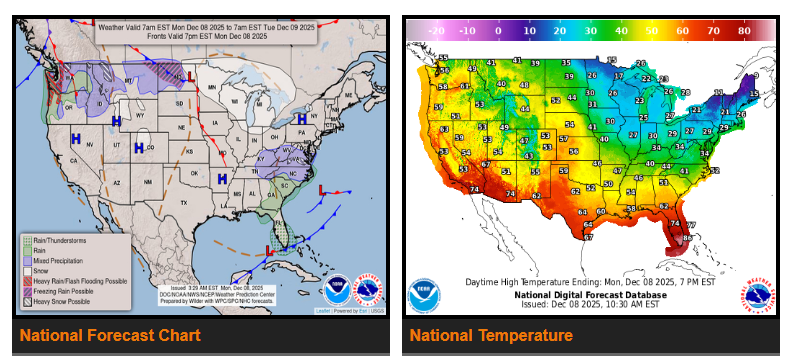
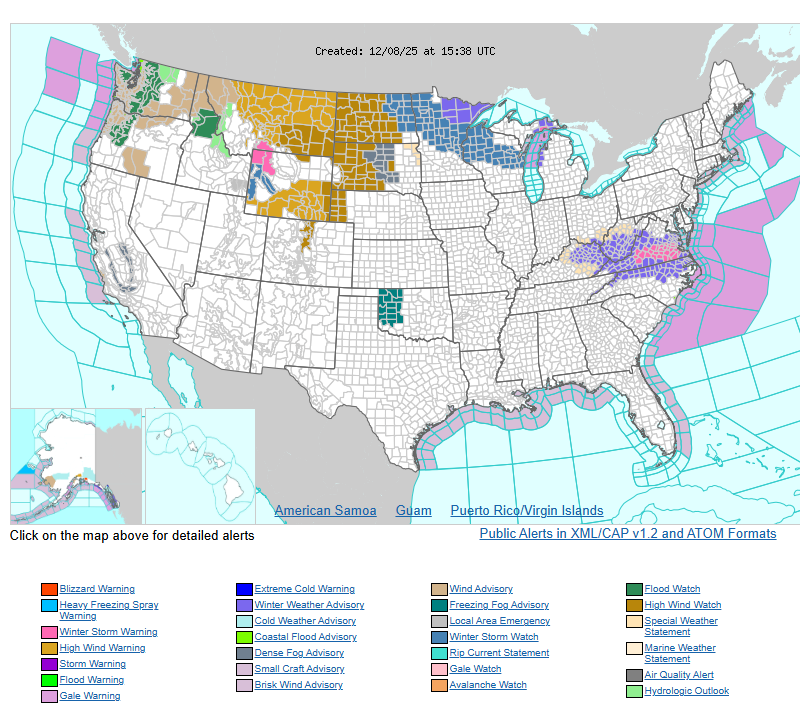
A strong atmospheric river will bring several days of heavy rain to the Pacific Northwest. Rainfall will increase this morning across coastal Washington and Oregon, with periods of heavy rain and a risk of isolated flash flooding through midweek. Flood Watches are already in place. Gusty winds are also expected across the Pacific Northwest, Northern Rockies, and Northern Plains today and Tuesday as a strong system moves through.
By late Tuesday, this system will push into the Northern Plains and Upper Midwest, bringing the potential for a few inches of snow and some freezing rain from eastern North Dakota into western Minnesota. A Winter Storm Watch is in effect from Fargo to Grand Rapids.
Farther east, snowfall amounts have increased for the central Appalachians and southern Mid-Atlantic. South-central Virginia, including the Richmond area, is under a Winter Storm Warning with 3–5 inches of snow expected through this evening. Surrounding areas should see 1–2 inches, with Winter Weather Advisories posted.
WYOMING
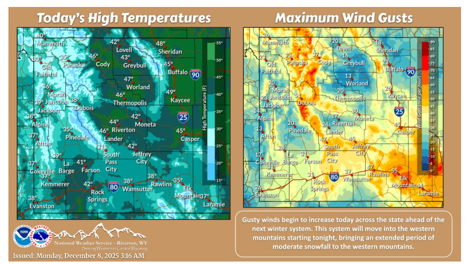
The next winter system will begin to impact the region today, starting with gusty winds across southern WY. Gusty winds will ramp up today and tonight, before peaking on Tuesday. Moderate snow will move into the western mountains tonight, with snow continuing for most of the remainder of the week. Warm temperatures will limit any snowfall for lower elevations this week.
Have a fantastic day.