
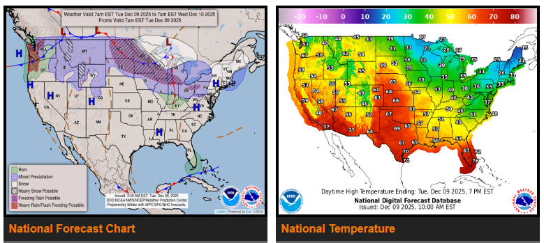
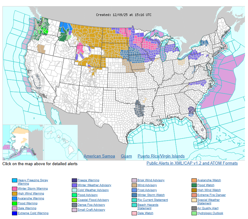
A strong atmospheric river will bring several days of heavy rain to Washington and Oregon. Flash-flood risks and gusty winds are expected through midweek. The northern Rockies, including Montana and Wyoming, will see more than a foot of new snow in higher elevations, along with strong winds and reduced visibility.
A clipper system moving through the northern Plains into the Upper Midwest will bring four to eight inches of snow to North Dakota, South Dakota, Minnesota, and Wisconsin. Strong, gusty winds will follow the snow and create blowing-snow hazards. By Wednesday, a stronger clipper will bring heavy snow and high winds to the Great Lakes region, including Michigan and northern Indiana and Ohio.
The central and southern Plains, including Kansas, Oklahoma, and Texas, will experience dry and mild weather. The Southwest, including New Mexico and Arizona, will also stay dry and warmer than normal. In Florida, rain will taper off as a cold front moves away from the region.
WYOMING
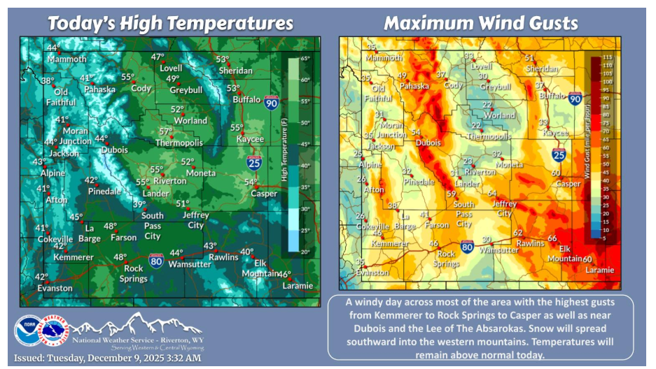
An active day across the area with mountain snow and strong to high wind across much of the area. Temperatures will remain above normal for early December.
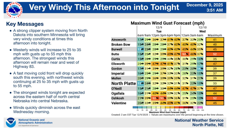
Westerly winds will increase to 25 to 35 mph with gusts up to 55 mph this afternoon. The strongest winds this afternoon will remain near and west of Highway 83. A fast moving cold front will drop quickly south this evening, with northwest winds continuing at 25 to 35 mph with gusts up to 55 mph. The strongest winds tonight are expected from eastern portions of north central Nebraska into central Nebraska.
Have a fantastic day.