
Pacific Northwest & Northern Rockies:
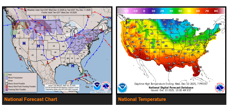
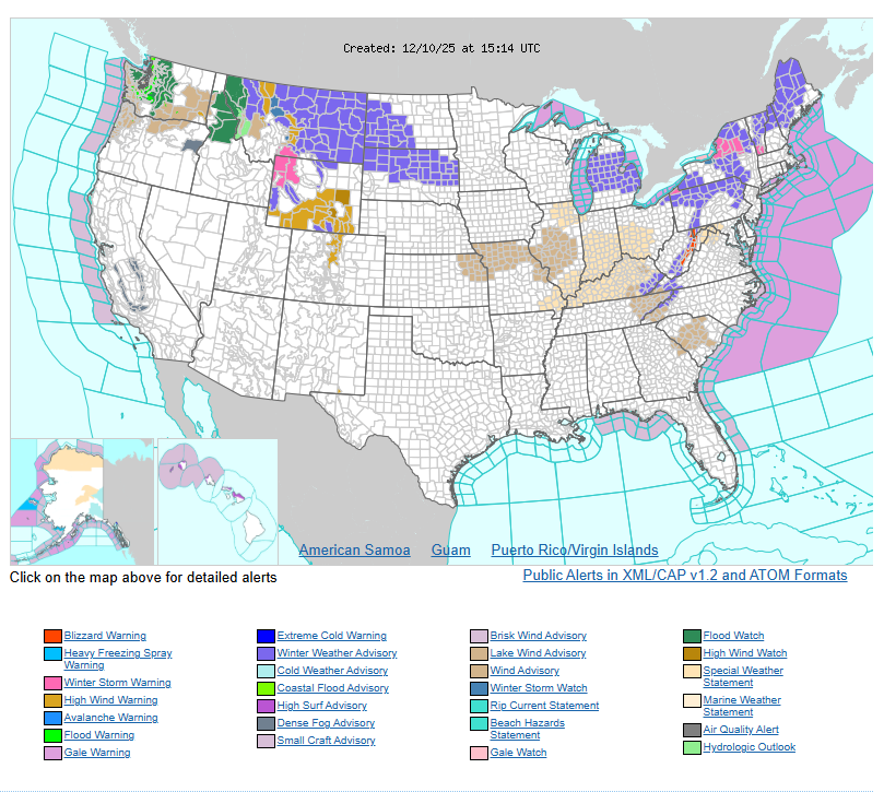
A prolonged atmospheric river continues to bring heavy rain to Washington, Oregon, and lower elevations of Idaho and Montana. Snow levels are very high (7,000–8,000 ft), so most impacts are rain and possible flooding. Higher mountains in the Cascades and northern Rockies may see heavy snow.
Northeast & Appalachians:
A strong system is moving in today, bringing heavy snow and strong winds to the interior Northeast and Appalachians. Snow totals of 4–6″ are expected in many areas, with blizzard conditions possible in parts of the central Appalachians where winds may reach 50 mph.
Areas like Tug Hill and the Adirondacks could see 8–16″ of snow through Thursday. Another system later this week may bring freezing rain and more snow from Montana into the Ohio Valley.
Temperatures:
Cold air continues across the central and eastern U.S., with highs in the teens and 20s across the Northern Plains and Great Lakes, 20s–30s across the Midwest and Ohio Valley, and 40s–50s in the Mid-Atlantic and Southeast. Warmer weather remains in the West with 50s in the Pacific Northwest, 60s–70s in California, and 70s–80s in the Desert Southwest.
WYOMING
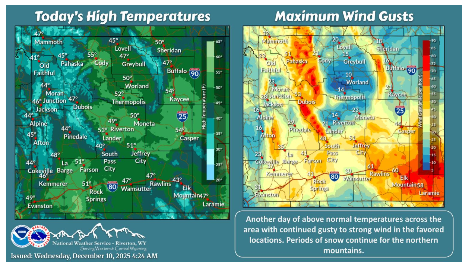
More of the same today with above normal temperatures, snow in the northern mountains and a gusty to strong wind in the favored locations in central and southern Wyoming.
Have a fantastic day.