
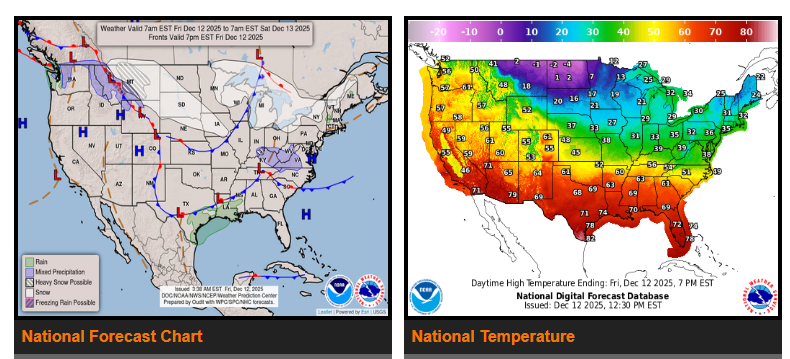
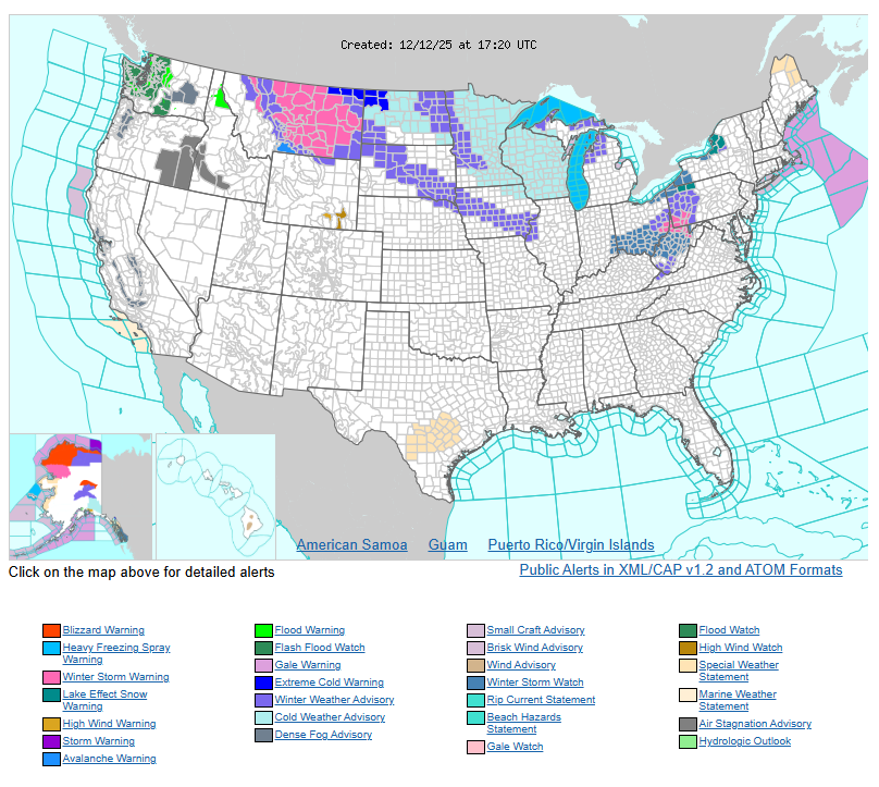
Drier weather is expected across the Pacific Northwest this weekend, but major to catastrophic flooding will continue in parts of western WA and northwest OR for several days. The improvement in rainfall comes as a strong ridge builds over the West while a deep upper-level low settles over the central and eastern U.S., creating sharp temperature contrasts nationwide.
Much above-normal temperatures will stretch from the West Coast through the Southwest, Great Basin, Rockies, and into the Southern Plains. Low clouds and fog in the Central California Valley will keep temperatures cooler there, but many areas across the Southwest, CA, and the Great Basin may see record highs and warm overnight lows today and Saturday.
In contrast, arctic air is pushing into the Northern Plains, Upper MS Valley, and Midwest through Saturday, bringing temperatures 20–30°F below average. Some locations may see record-cold daytime highs Saturday, with broader cold-temperature records possible Sunday across the OH and TN Valleys.
A swath of moderate to heavy snow will develop from the Northern Plains into the Middle MS Valley today, then spread into the Midwest and Central Appalachians on Saturday as the arctic air deepens and a mid-level disturbance moves east.
Lake-effect snow off the Great Lakes will ease today but is expected to strengthen again Saturday into Sunday as colder northwesterly winds and arctic air move back over the region.
WYOMING
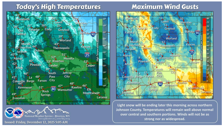
Snow will be end by midday over northern Johnson County. Temperatures will be closer to normal over northern portions in the wake of a cold front, while central and southern portions stay well above normal. Winds will be gusty again, but not nearly as strong or as widespread.
NEBRASKA
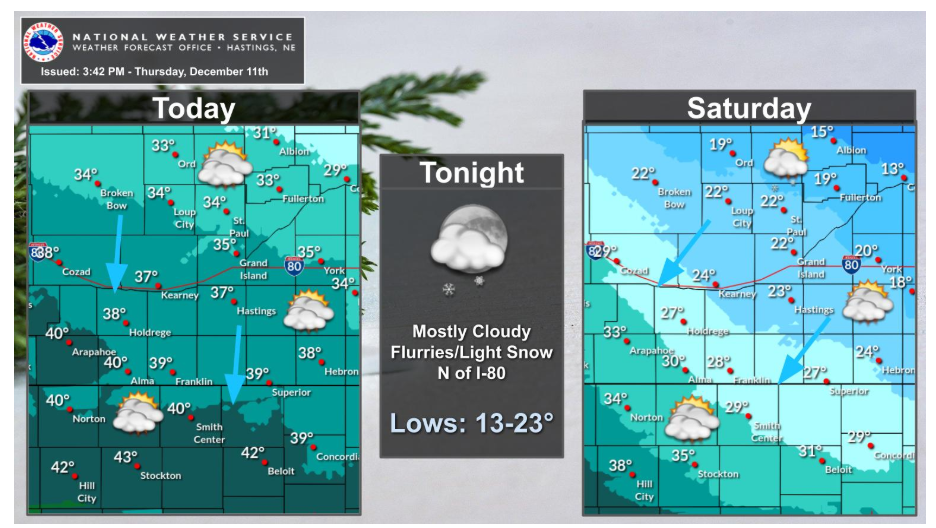
Much cooler today under cloudy skies and modest northerly winds. Can’t rule out some off and on flurries N of I-80. Even colder temperatures will slide into the region for Saturday. In fact, some areas will experience steady or falling temperatures through the daytime hours. A dusting of light snow will be possible for areas from around Ord to Fullerton to Columbus tonight into Saturday.
Have a fantastic day.