
Good morning Inland Xpress Drivers – Do you know what weather is up ahead of you? Have you planned out your shift for the day? Here is some helpful weather information to assist you because we have few troublesome areas.
Extreme Fire Weather Concerns; Strong Winds for West and East
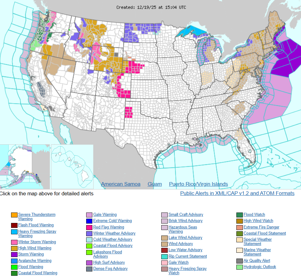
Powerful winds, warm temperatures and low humidity may result in a rapid spread of wildfires across the front-range of Colorado and Wyoming, including portions of the western and southern Plains today. Meanwhile, Pacific moisture continues for the west with heavy rainfall and mountain snow. A strong cold front moves off the east coast today with heavy rainfall, strong winds and lake effect snow.
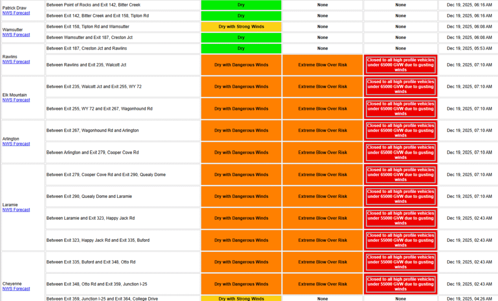
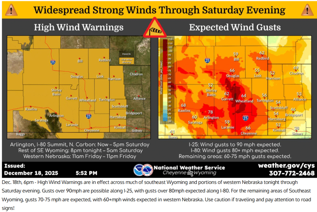
WYOMING HAS CRAZY HIGH WINDS – RAWLINS TO LARAMIE SHOWING RESTRICTIONS FOR ANY HIGH-PROFILE VEHICLES UNDER 65,000 LBS……..Sooooo make sure you know your weights especially your gross vehicle weight. I-70 in Colorado has just as bad wind gusts west of Denver that doesn’t make a good alternative option.
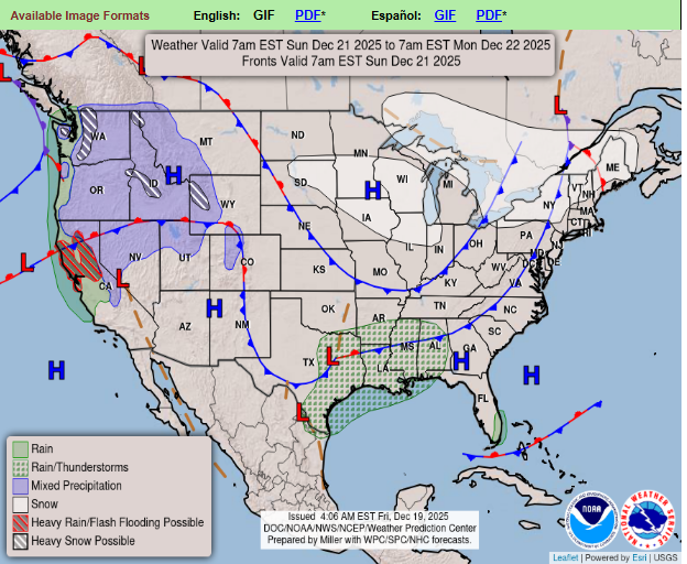
SUNDAYS FORECAST – Iowa, Illinois and Indiana forecasting for protentional snowy conditions. Watch your speeds! Slow down on those icy and/or snowy roadways.
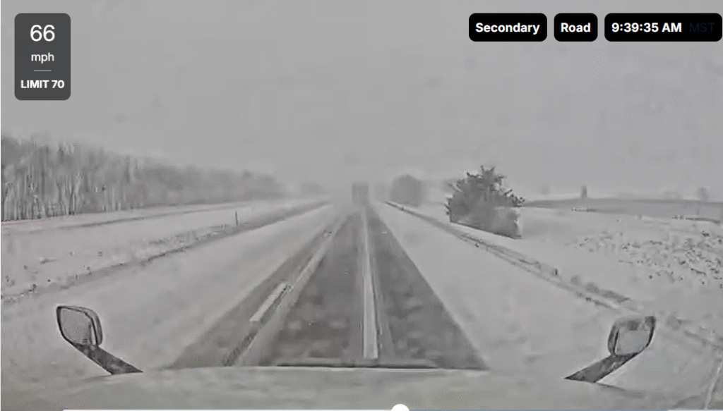
Look at the example below, 66mph on these roads will always end in a disaster. Also, do not pass/change lanes either when the left lane looks even worse. That will even increase your chances of a jackknife accident. Slow and steady gets you back home safely in these bad weather conditions. If you need to pull off somewhere safe, please call dispatch/ops to notify them so we can update the customer about any delays. COMMUNICATE!
In conclusion, anyone that has made this far on this post, please call me by the end of the day and I will reward you handsomely or beautifully for taking the time to go through this weather post. Thank you for all you do. I personally know how hard you have it, especially through these winter months which will get even worse come the New Year! Your efforts do not go unnoticed.
Love,
Adam in Safety (801-679-4277).