
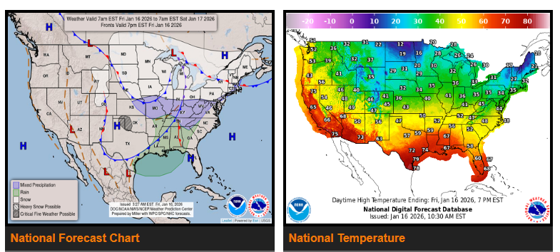
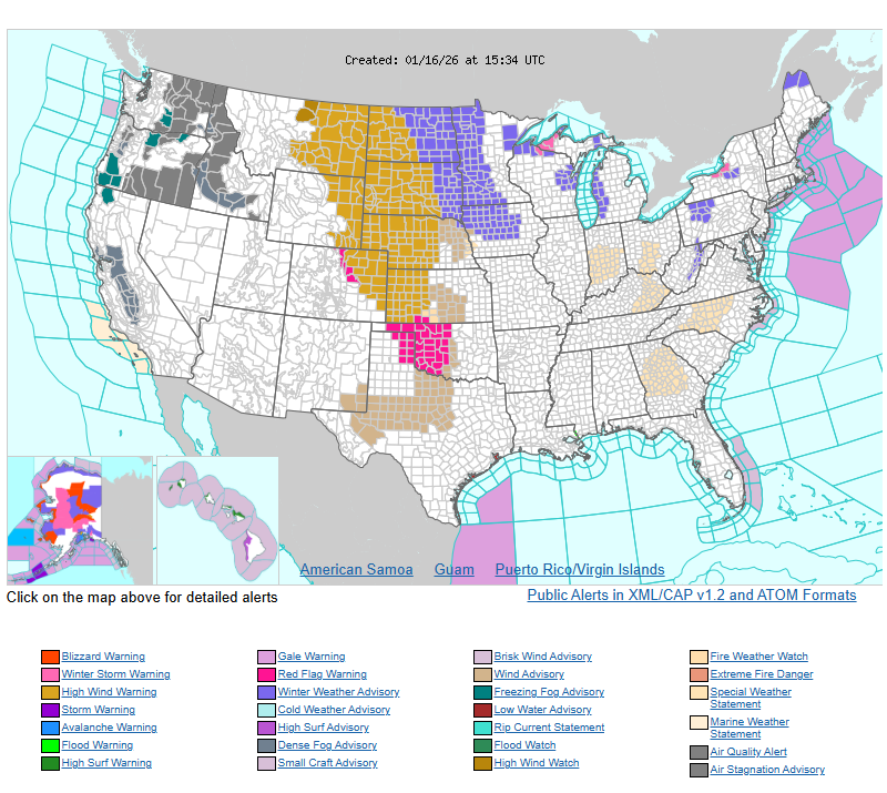
Widespread snow squalls will create dangerous travel conditions across parts of the Northern and Central Plains and the Midwest through tonight. Snow squalls will spread into the Upper Midwest today and may reach the Ohio Valley tonight, with some areas seeing multiple rounds. These squalls can cause sudden heavy snow, strong wind gusts, icy roads, and near-zero visibility. Conditions may change rapidly, making travel extremely hazardous.
Very strong winds are also expected today across the Northern and Central Plains, with gusts potentially exceeding 60 mph. High wind warnings and advisories are in effect across much of the Great Plains. These winds will make travel difficult, especially for high-profile vehicles, and could lead to isolated power outages. Fire weather concerns are elevated across the eastern Oklahoma and Texas Panhandles and western Oklahoma due to dry conditions and gusty winds.
Behind this system, an Arctic cold front will bring much colder temperatures to the Plains starting tonight. Highs in the teens and single digits across parts of the Northern and Central Plains and Upper Midwest will run 20–30 degrees below normal on Saturday. This bitter cold will continue spreading east into the Midwest late Saturday into Sunday.
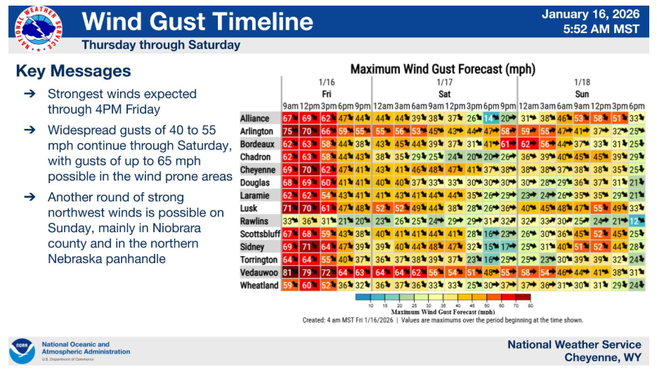
WYOMING
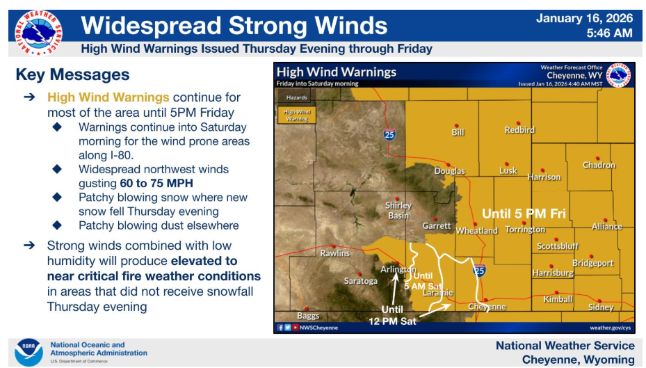
High wind warnings remain in effect through 5PM for most of the area
NEBRASKA
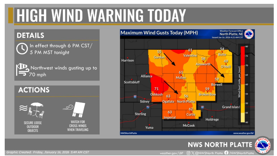
A High Wind Warning remains in effect through this evening across western and north central Nebraska. Strong northwest winds of 35 to 45 mph may gust as high as 70 mph this afternoon.
Have a nice and safe day.