
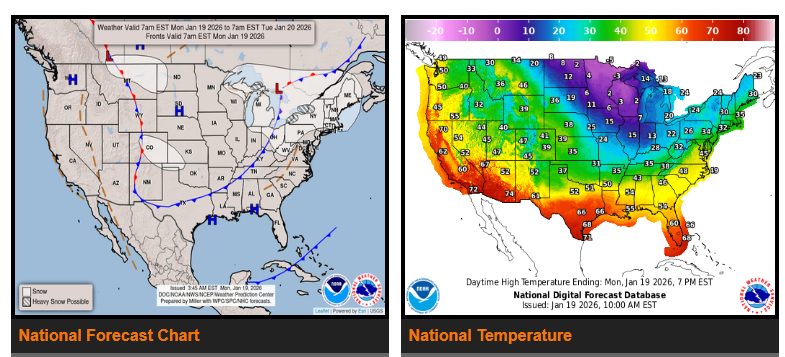
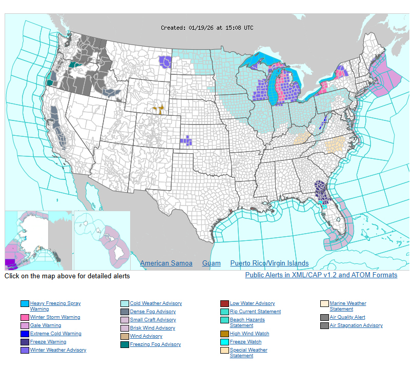
Heavy lake-effect snow is expected downwind of the Great Lakes through Tuesday due to strong winds and extremely cold air moving across the region. Accumulations of 8–12 inches are likely, with isolated higher amounts possible by early Wednesday. Temperatures across much of the Midwest will remain in the single digits to below zero, running 20–30 degrees below normal and creating very hazardous driving conditions. In the Southeast, clear skies and cold overnight temperatures will bring freeze warnings for portions of southern Georgia into northern and central Florida, with lows in the low to mid-30s early this morning and again tonight. Elsewhere, above-average temperatures will continue across the West, while an additional system is expected to bring more snow showers to the Northern Plains and Upper Midwest on Tuesday.
WYOMING
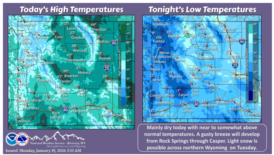
High pressure will bring a dry day to western and central Wyoming today. A weak front may bring light snow to northern Wyoming on Tuesday.
Have a nice and safe day.