
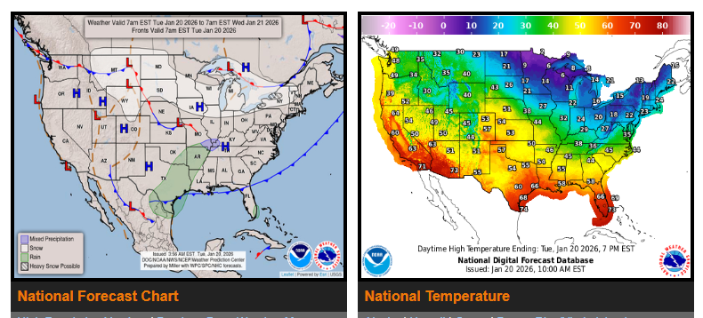
Lake-effect snow will continue downwind of the Great Lakes over the next few days due to cold west to northwest winds. Most affected areas can expect 6–12 inches of snow, with locally higher totals, especially east of Lake Ontario where heavier snow is likely today.
A frigid Arctic air mass remains in place from the Midwest through the Northeast and Mid-Atlantic today. High temperatures will stay in the teens and 20s, running 15–25 degrees below normal.
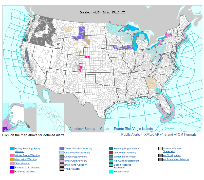
Freeze warnings remain in effect from southern Georgia through central Florida tonight, with temperatures near or below freezing. Conditions will begin to improve on Wednesday as warmer air moves in ahead of an approaching low-pressure system.
In the West, an upper-level ridge will keep above-average temperatures in place for the next several days. By late Wednesday into Thursday, a developing storm system along the California coast may bring rain and snow to parts of the Sierra Nevada. This system could strengthen and lead to a major winter storm across parts of the Central and Eastern U.S. starting Friday.
WYOMING
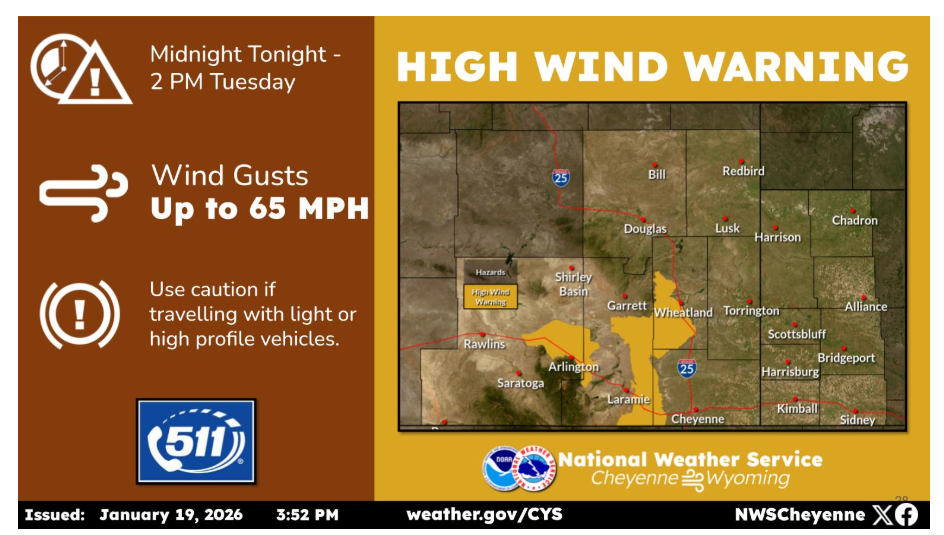
All High Wind Watches have been upgraded to High Wind Warnings from midnight tonight through 2 PM Tuesday. Wind gusts 65+mph are expected. Use caution if traveling with light weight or high profile vehicles, including campers.
Have a nice and safe day.