
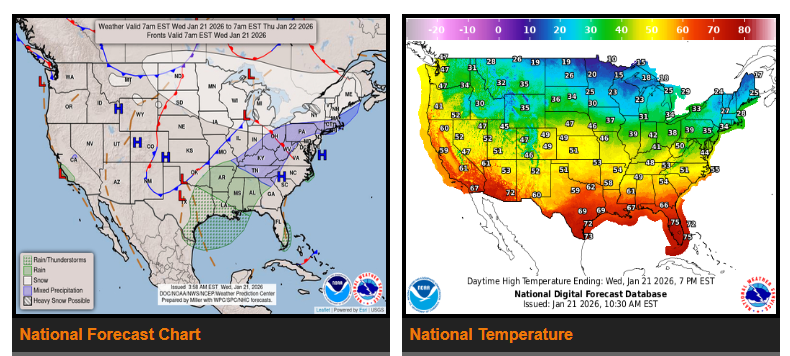
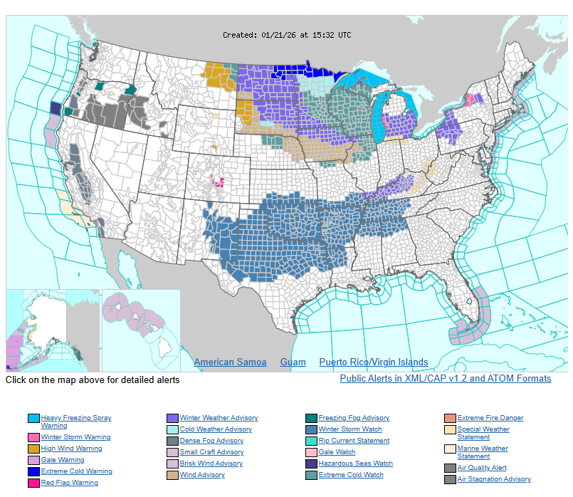
Lake effect snow will continue downwind of the Great Lakes over the next couple of days as multiple low-pressure systems move through the region. Snowfall totals of 6–12 inches are expected in most lake-effect areas, with higher amounts possible. Areas downwind of Lake Ontario could see up to 2 feet of snow by Friday morning. Winter storm warnings are in effect near Lakes Michigan and Ontario.
At the same time, dangerously cold Arctic air will spread across much of the country. Sub-zero and single-digit temperatures will move from the Northern Plains into the Midwest, Ohio Valley, and Northeast from Thursday through the weekend. Gusty winds will make conditions even more dangerous, with wind chills dropping below -50°F in parts of the Northern Plains. Extreme cold warnings, watches, and advisories are in effect across portions of the Northern Plains and Upper Midwest starting tonight.
This intense cold air mass, combined with a frontal boundary to the south, is expected to trigger a major winter storm from the Central and Southern Plains toward the East Coast beginning Friday and lasting through the weekend.
WYOMING
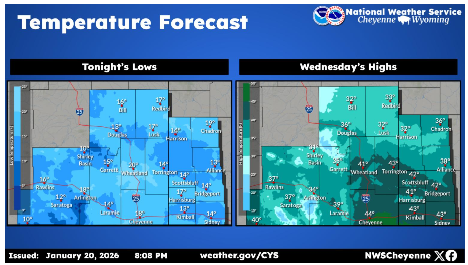
Here is a look at tonight’s forecast lows across the CWA and Wednesday’s high temperatures. Temperatures will continue to cool in the days ahead.
NEBRASKA
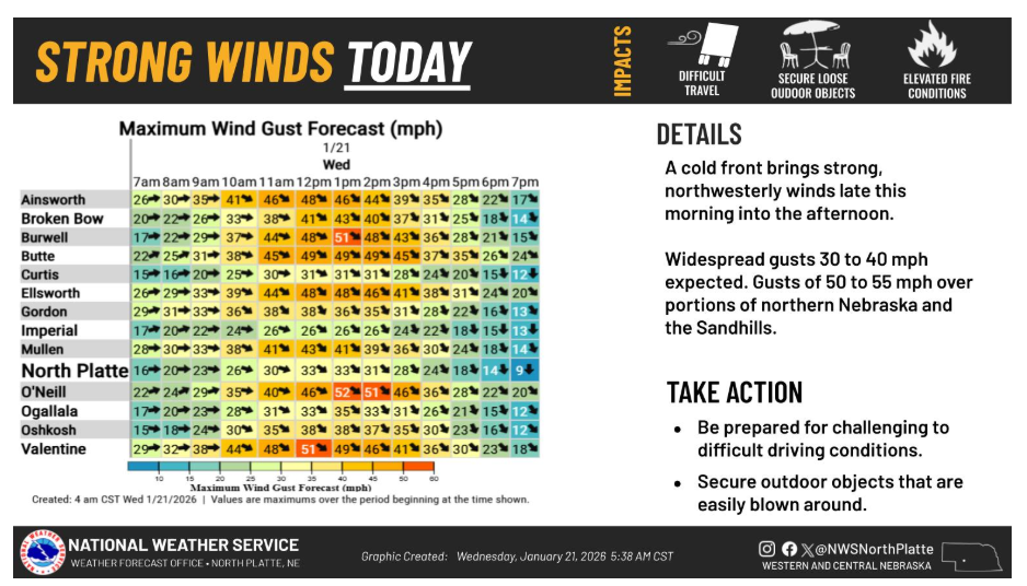
Strong and gusty northwest winds are expected across western and north central Nebraska today. The strongest wind gusts are expected across northern Nebraska and the Sandhills, where gusts of 50 to 55 mph are possible!
Have a nice and safe day.