
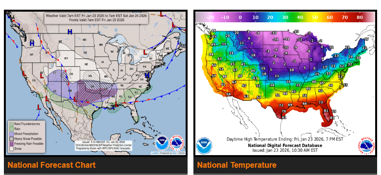
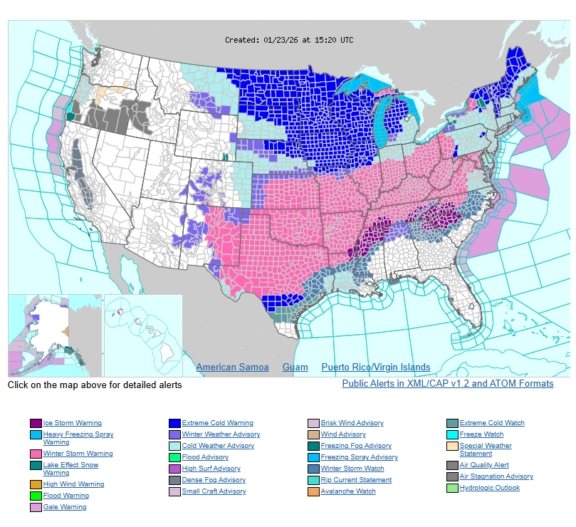
A significant winter storm will impact much of the country from Friday through Monday, bringing heavy snow, widespread ice, and dangerous cold. Heavy snow is expected across the Central and Southern Plains and the Middle to Lower Mississippi Valley, while significant to potentially catastrophic ice accumulation is likely from the Southern Plains into the Southeast.
Bitterly cold temperatures and dangerously low wind chills will spread from the Southern Plains through the Great Lakes and into the Northeast as strong high pressure moves south from Canada. At the same time, multiple low-pressure systems tracking along the Gulf Coast and toward the Southeast and Mid-Atlantic will fuel a long-duration winter storm.
This system will produce widespread heavy snow from the Southern Rockies and Plains through the Ohio Valley, Mid-Atlantic, and into the Northeast. Snowfall totals of more than twelve inches are likely in several areas, leading to major travel disruptions and hazardous road conditions.
Freezing rain and sleet are expected across the Southern Plains, Lower Mississippi Valley, Tennessee Valley, and the Southeast. Ice accumulation could be severe, resulting in power outages, tree damage, and extremely dangerous or impassable travel.
After the storm passes, extreme cold and dangerous wind chills will persist from the Southern Plains to the Northeast, prolonging hazardous travel and impacting infrastructure. Additional snowfall is expected from lake-effect snow near the Great Lakes, upslope snow in parts of the Northern and Central High Plains, and rain with higher-elevation snow across the Southwest.
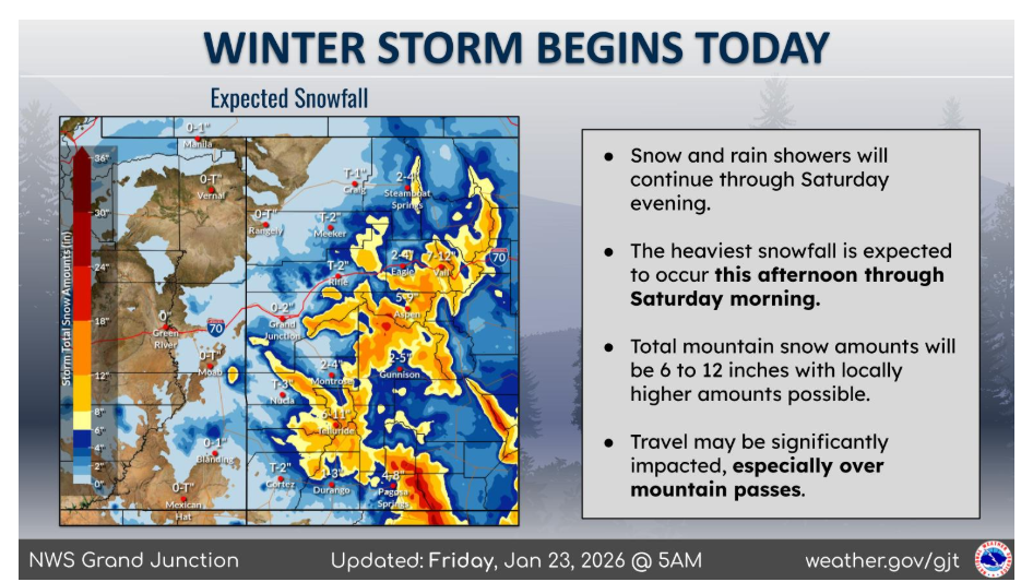
A winter storm has begun, and will continue through Saturday evening. The heaviest snowfall is expected to occur this afternoon through Saturday morning. In the mountains there will be 6 to 12 inches of snow, with locally higher amounts possible. Travel may be significantly impacted from this storm, especially over mountain passes.
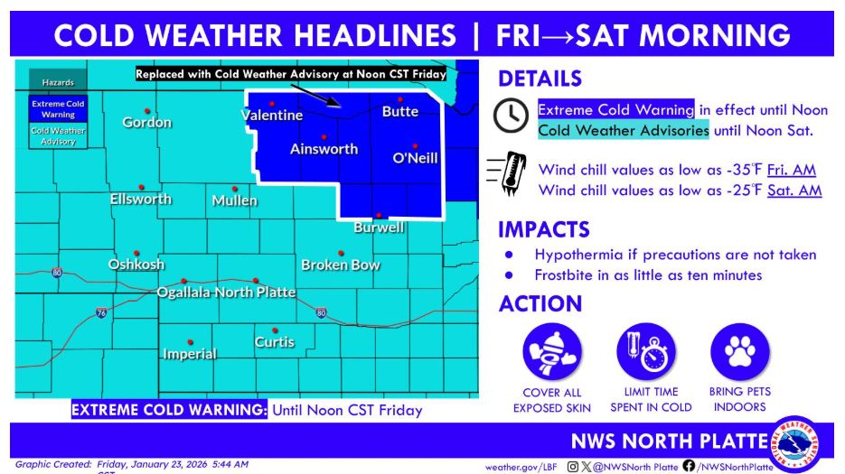
Dangerous cold continues across north central Nebraska. An Extreme Cold Warning remains in effect until Noon CST Friday, when it will be replaced by a Cold Weather Advisory. All Cold Weather Advisories continue through Noon CST Saturday. Wind chills may reach around -35°F Friday morning, coldest across north central Nebraska, and -25°F Saturday morning, creating a risk for frostbite in minutes.
Have a good and safe day.