
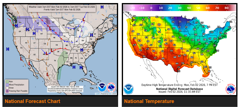
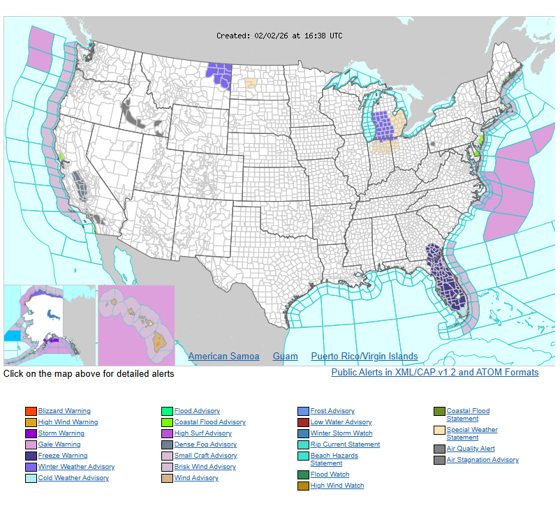
Extreme Cold/Freeze Warnings remain in effect early this morning across much of Florida, southern Georgia and Alabama, portions of the Carolinas, and southeastern Louisiana. Conditions will slowly begin to moderate, with a warming trend expected by Tuesday. However, temperatures will still remain below normal for early February across the Florida Peninsula. Another surge of arctic air will move into the Great Lakes and Ohio Valley Tuesday into Wednesday morning.
A series of Alberta clippers will bring periods of light snow across the Great Lakes today, along with light snow or a wintry mix across the Northern Plains over the next couple of days. An arctic front will follow into the Great Lakes on Tuesday.
Most of the western U.S. will stay quiet with above-normal temperatures. The main exception will be the Pacific Northwest, where rain arrives today before tapering off tonight.
Late today, a weak disturbance crossing the Rockies will help form a frontal wave over the Southern High Plains. This system will pull Gulf moisture northward, increasing the chance of showers and a few embedded thunderstorms across parts of the South on Tuesday.
By Tuesday night into Wednesday morning, the system will track northeast toward the Mid-Atlantic and meet reinforcing arctic air from the Great Lakes. This will likely produce an area of light snow across the Ohio Valley Tuesday, spreading into the central Appalachians Tuesday evening and into the Mid-Atlantic overnight, before moving offshore early Wednesday.
Meanwhile, showers and scattered thunderstorms will continue across the South and Southeast into Wednesday morning.
WYOMING
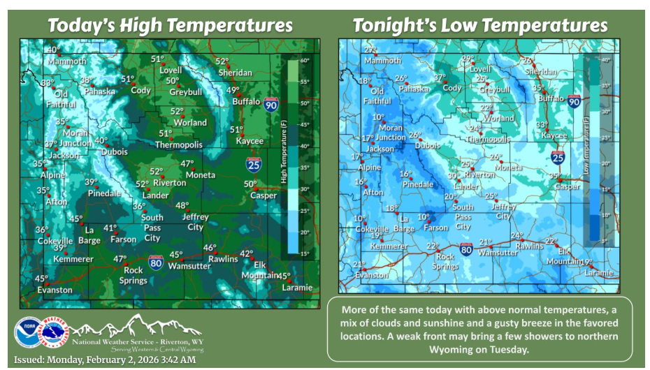
The week starts off much like last weekend with dry conditions, above normal temperatures and breezes in the normal locations. Other than a few showers Tuesday, most of the week looks to remain dry.
Have a nice and safe day.