
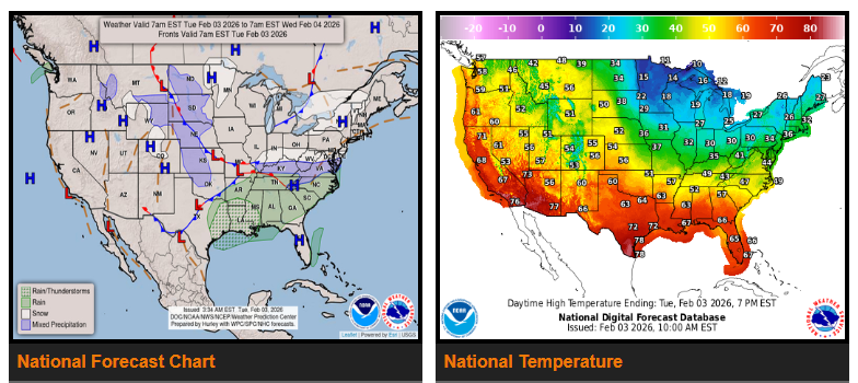
A developing low pressure system will bring light wintry precipitation from the Upper Ohio Valley into the Mid-Atlantic, while rain and thunderstorms spread from the South into the Southeast through Wednesday.
Cold conditions across Florida will begin to ease after one more morning of freezing temperatures and wind chills in the 20s. A warming trend will follow, with temperatures returning to the 70s by Wednesday afternoon, closer to normal for early February.
The main weather system over the next couple of days will track east from the southern Plains across the South and into the Southeast on Wednesday, reaching Florida by Thursday morning. Gulf moisture will fuel showers and scattered thunderstorms, starting today across eastern Texas and expanding through the Ark-La-Tex region this afternoon. Rain will continue across the South tonight and into the Gulf Coast and Southeast on Wednesday.
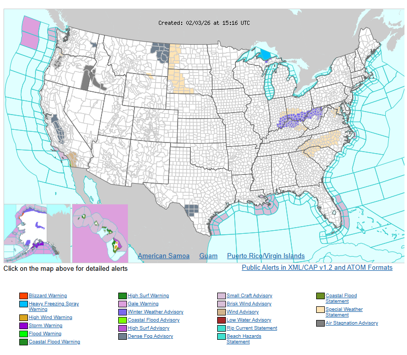
North of this system, another push of arctic air into the Great Lakes will bring a period of light wintry precipitation from the Upper Ohio Valley later today, spreading into the central Appalachians and Mid-Atlantic tonight into Wednesday morning before tapering off.
Across the northern states, Alberta clippers will bring occasional light snow to the Great Lakes mainly today. Cooler air will briefly return, but warmer-than-normal conditions are expected to develop across the northern High Plains by Thursday.
Much of the western U.S. will remain mild and dry.
WYOMING
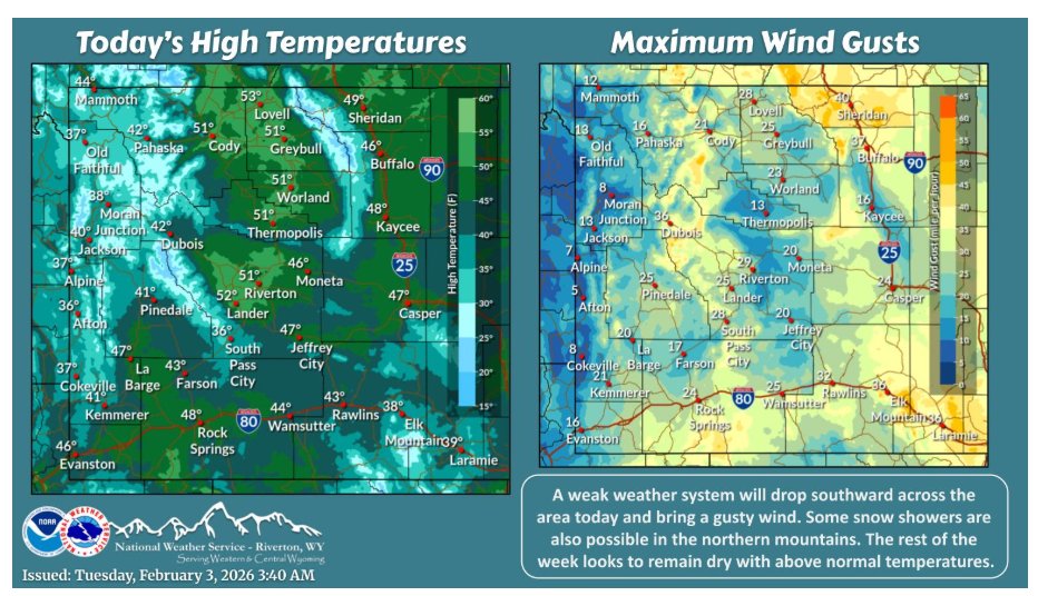
weak weather system will bring some showers to the northern mountains and Johnson County and breezy conditions for many today. The remainder of the week looks dry with continued above normal temperatures.
Have a nice and safe day.