
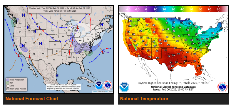
A fast-moving clipper system will bring snow, strong winds, and dangerously cold temperatures from the Great Lakes through the Northeast and Appalachians into the weekend.
Widespread light to moderate snow is expected Friday, with most areas receiving 1–3 inches. Heavier totals are possible downwind of Lakes Erie and Ontario and across parts of the central and southern Appalachians. Snow will reach coastal New England on Saturday, where some areas could see 4–5 inches.
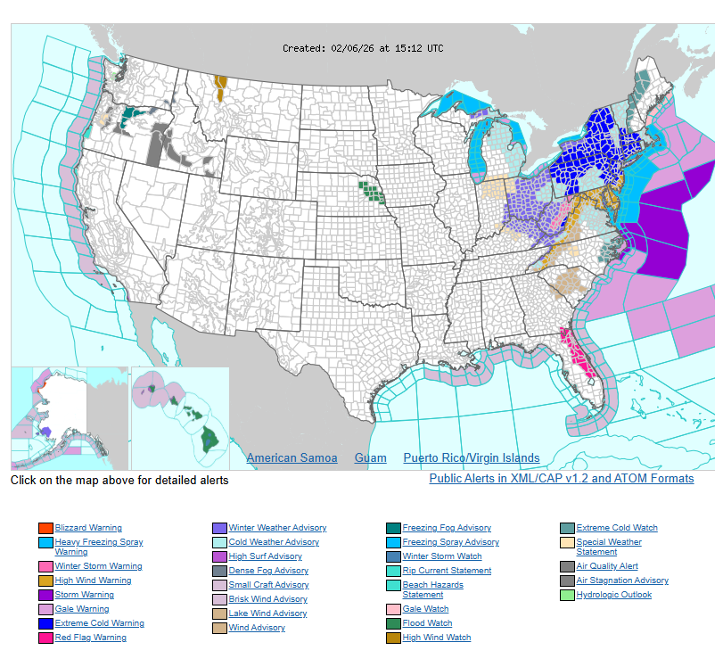
Strong winds, with gusts up to 60 mph in parts of the Mid-Atlantic, will accompany the system. Even where snowfall amounts are lighter, these winds may cause snow squalls with sudden bursts of heavy, blowing snow and hazardous travel conditions.
Behind the cold front, bitterly cold air will settle in. High temperatures Saturday will drop into the single digits, teens, and 20s. Wind chills could fall as low as -30 in parts of interior New England and the Northeast, with negative single digits and teens closer to the coast. These conditions create a serious risk of frostbite and hypothermia.
Meanwhile, a series of Pacific systems will bring increasing moisture into the Pacific Northwest. Moderate to locally heavy rainfall is expected, especially along the Olympic Peninsula in Washington, where isolated flooding is possible. Snow will fall in the Cascades and other higher elevations. Moisture will spread inland into the northern Great Basin and northern Rockies late Saturday into early Sunday, bringing valley rain and mountain snow. Scattered showers and thunderstorms are also possible across parts of the Southwest and west Texas.
Cold conditions will continue across much of the eastern U.S., with highs mainly in the 20s and 30s across the Ohio Valley, 40s and 50s in the Southeast, and 60s in Florida.
In contrast, much of the central and western U.S. will remain well above average. Highs in the northern and central Plains could reach the 50s, 60s, and even low 70s — 30 to 40 degrees above early February averages. The Interior West will see highs in the 40s to low 60s, while the southern Plains, Southwest, and California may reach the 60s, 70s, and even low 80s. The Pacific Northwest will stay closer to seasonal averages, with highs mainly in the 50s.
WYOMING
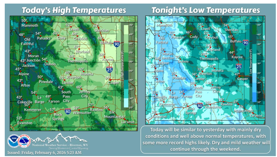
High pressure brings another dry and mild day today with more record high temperatures. Well above normal temperatures will last through the weekend.
Have a fantastic day.