
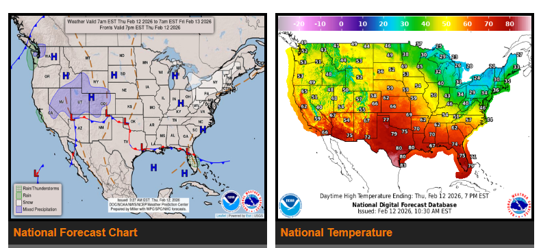
An upper-level low pressure system will bring precipitation to parts of the South and Central Plains into the Southeast over the next couple of days. Meanwhile, post-frontal snow is expected across the Great Lakes, with higher elevation snow in portions of the Interior West. Above-normal temperatures will continue across much of the central and southern U.S.
A deepening trough over the western U.S. and a ridge over the central Plains and Mississippi Valley will guide this system eastward. A surface low currently over the Southwest will move into the southern and central Plains by Friday, then into the Mississippi Valley by Saturday. As moisture moves north from the Gulf, rain chances will increase across the Southern Rockies, South and Central Plains, and into the Lower Mississippi and Tennessee Valleys.
Most of the rainfall is expected to be beneficial, but parts of the Southern Plains are under a Marginal Risk for excessive rainfall on Friday, with localized flash flooding possible. There is also a Marginal Risk for severe thunderstorms across portions of west Texas, including the potential for large hail. Rain will continue spreading into the Southeast Friday evening into Saturday as the system moves northeast.
Behind the system, colder air will bring lake-enhanced snow showers to the Great Lakes through early Friday. Additional snow bands are possible downwind of Lakes Erie and Ontario, as well as across parts of New England and the central Appalachians. Snow amounts will generally be light to moderate, with higher totals in elevated areas. Snow is also expected in the Cascades on Friday, spreading into the Interior West through Saturday, with light to moderate accumulations.
Above-average temperatures will continue across much of the country. The Central U.S. will see the warmest conditions, with highs 15 to 30 degrees above normal, reaching the 60s and 70s. The West will see highs mainly in the 50s and 60s, while the Northeast will experience temperatures in the 30s and 40s.
WYOMING
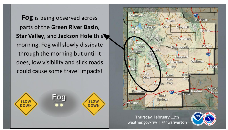
Fog is being observed across parts western Wyoming this morning. Anticipate slick roads and low visibility until fog dissipates later this morning. Take it slow!
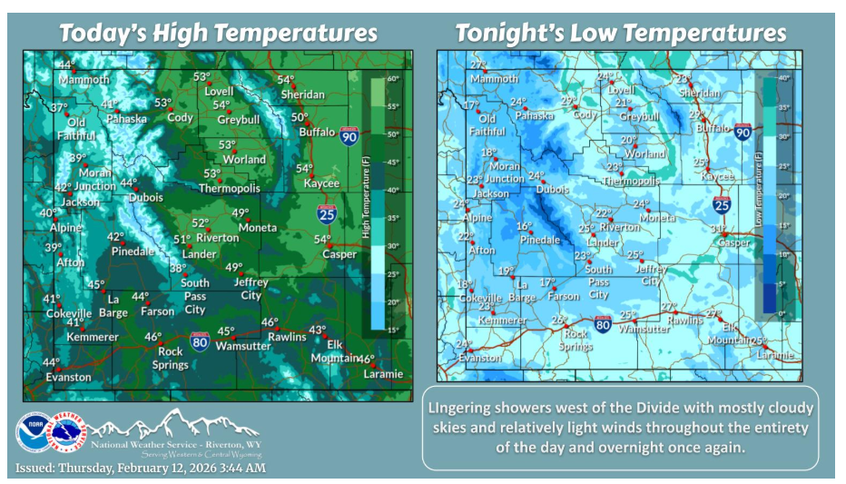
Lingering showers west of the Divide this morning with mostly cloudy skies and relatively light winds. Temperatures about seasonable to the west, and above average to the east.
Have a nice and safe day.