
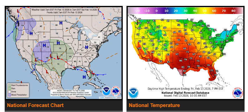
A storm system will bring widespread rain to the South and Southeast this weekend. Rain will spread from the southern Plains into the lower Mississippi Valley and Southeast Friday into Saturday. Some areas could see thunderstorms, gusty winds, small hail, and pockets of heavy rain. Isolated flash flooding is possible in parts of east Texas, Arkansas, Louisiana, and Mississippi.
By Sunday, rain will move into the Southeast and Mid-Atlantic. Higher elevations in the Northeast may see a mix of rain and snow.
In the Pacific Northwest and Interior West, a front will bring light to moderate snow in the mountains Friday into Saturday. Snow chances will increase in the higher elevations of northern California by Sunday.
Temperatures will stay well above normal across much of the central U.S., running 15–30 degrees above average. Highs in the central and southern Plains and Southeast will reach the 60s and 70s, with parts of Texas seeing low 80s. The Northeast will stay closer to seasonal temperatures in the 30s and 40s. The Interior West and Southwest will remain mostly dry with slightly above normal temperatures through Saturday.
WYOMING
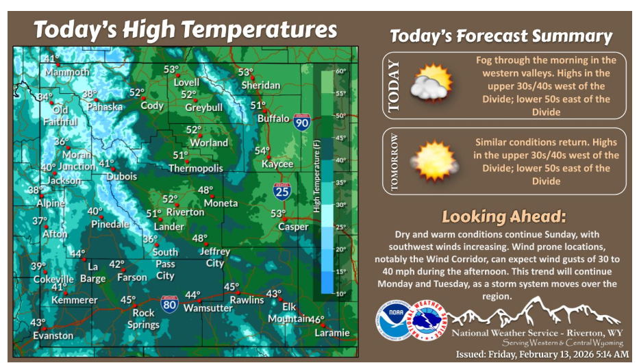
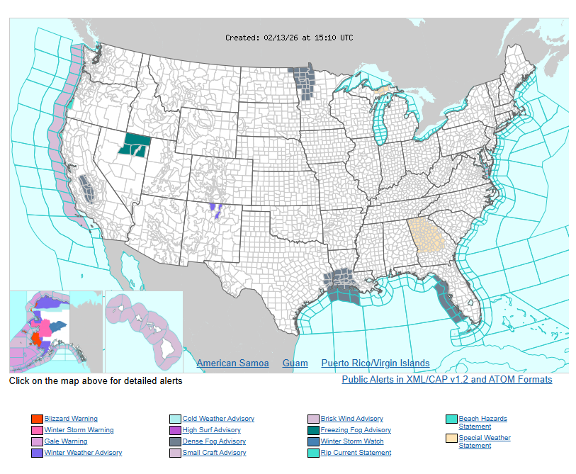
Fog will be in place over the western valleys this morning, lifting by midday/early afternoon. Otherwise, conditions will be dry with above normal temperatures continuing across the area. Similar conditions repeat for Saturday.
Have a nice and safe day.