
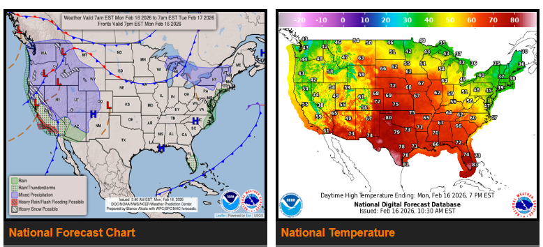
There is a slight risk of heavy rainfall along parts of the Central and Southern California coast on Monday. Localized flooding is possible, especially in burn scar areas. Another round of rain may move through on Tuesday. Heavy snow is expected in the Sierra Nevada Mountains, with the highest totals in the higher elevations. Periods of rain and mountain snow will also continue across parts of the Pacific Northwest and Rockies over the next few days.
By Tuesday into Wednesday, a system moving into the Northern Plains and Upper Great Lakes will bring rain that may change to snow in northern Montana and North Dakota. Wisconsin and Minnesota could see a mix of rain and snow by Wednesday.
Temperatures will remain much warmer than normal from the Central Plains into the Great Lakes, running 15 to 30 degrees above average, with some areas reaching the 70s to low 90s. The Eastern U.S. will see highs mainly in the 50s and 60s. Much of the Western U.S. will be cooler than normal, with highs in the 40s and 50s.
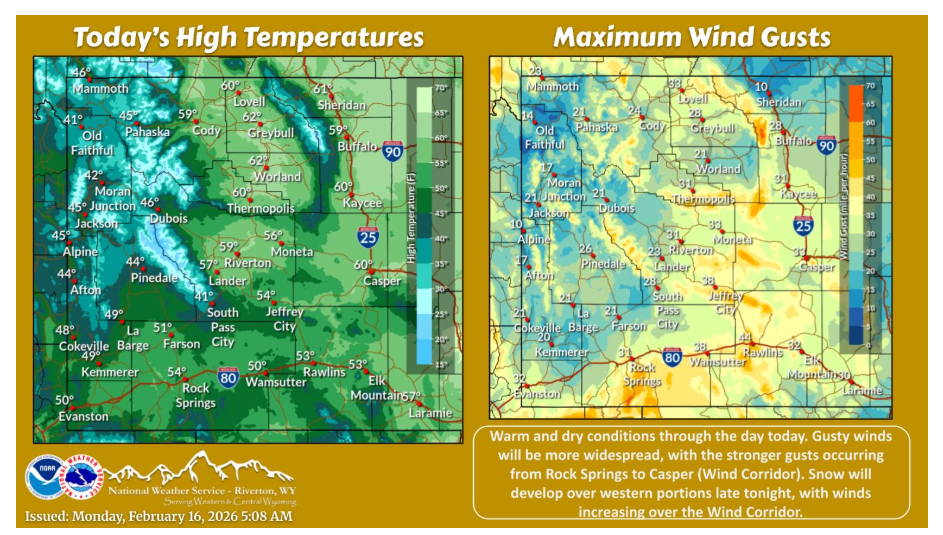
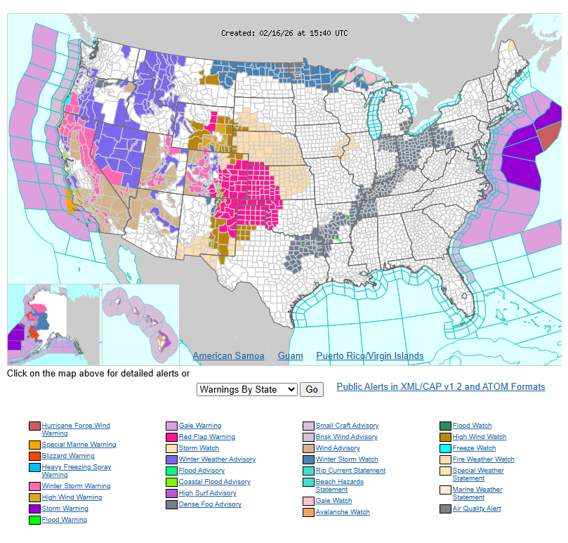
Dry and warm conditions return again today. Gusty winds will impact a few more locations, with the stronger gusts occurring from Rock Springs to Casper (the Wind Corridor). Critical fire weather will coincide in this area as well. Snow will develop over western portions late tonight. Winds will also increase over the Wind Corridor late tonight.
Have a nice and safe day.