
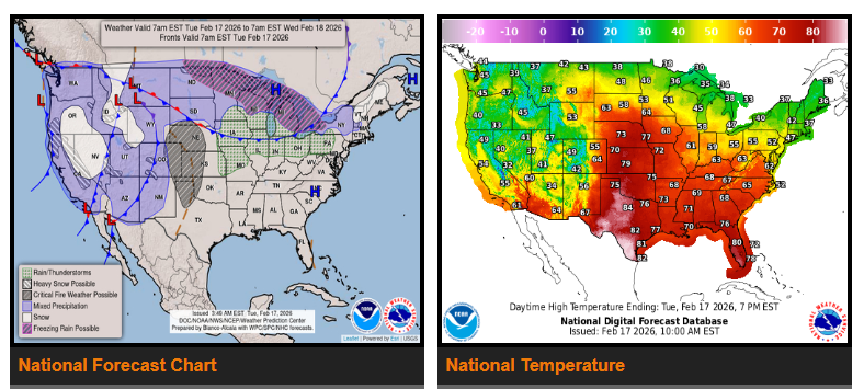
Snow and areas of rain/freezing rain are expected across the Upper Midwest.
An upper-level system remains over the West, bringing continued moisture into the region. While the heaviest rain has decreased, another round of rainfall is expected across parts of central and southern California, with 1–2 inches in lower elevations and 2–4 inches in higher elevations. There is a Marginal Risk for excessive rainfall and possible flash flooding, especially in burn scar areas.
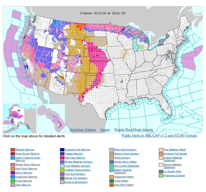
Heavy snow is expected in the Sierra Nevada and Cascade Mountains, with higher elevations seeing 12 inches or more through Thursday. Winter Weather Warnings and Advisories are in effect for several western states.
Across the Plains and Midwest, rain and snow are expected Tuesday evening, with heavier mixed precipitation possible across the Upper Midwest and Great Lakes on Wednesday. The system will continue moving east, bringing rain and higher elevation snow to parts of the Mid-Atlantic and Northeast through Thursday.
Temperatures will remain 15–30 degrees above normal across parts of the Plains and East Coast through Wednesday. Cooler air will move into the Plains by Thursday. The West will see below-normal temperatures, 10–25 degrees below average, with teens and single digits possible in parts of the Northern Rockies and Northern Plains by midweek.
WYOMING
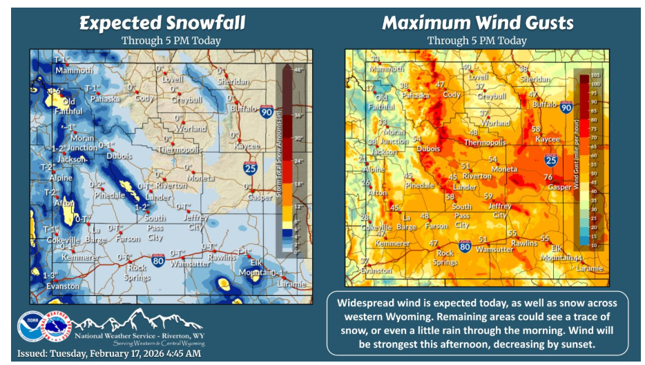
Widespread wind is expected today, as well as snow across western Wyoming. Remaining areas could see a trace of snow, or even a little rain through the morning. Wind will be strongest this afternoon, decreasing by sunset.
Along with increased snow chances and winds the next couple of days, a cold front will push through Wednesday brining with it colder, more seasonable temperatures for this time of year.
NEBRASKA
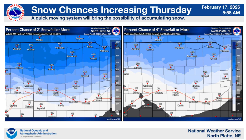
A fast moving but potent system will cross the area Thursday. Snow is looking more likely, especially for areas north of I-80. Strong winds Thursday afternoon into the evening could cause blowing snow. Image on left is the % chance of 2″+; on the right % chance of 4″+.
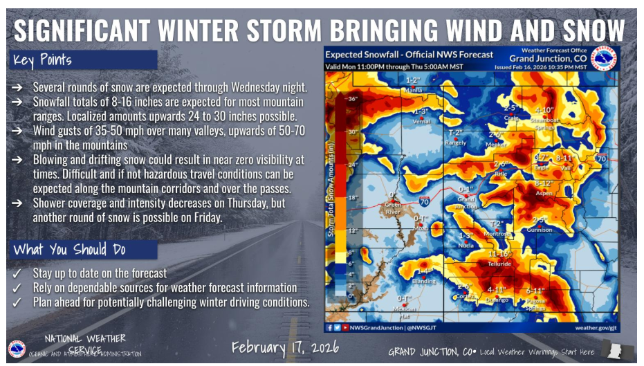
Winter has returned to western Colorado and eastern Utah. Significant mountain snow and strong winds will headline the forecast over the next few days. Travel will be hazardous at times, especially thru the mountain corridors as snow and wind combine to create near whiteout conditions. Strong winds will also impact travel in the lower elevations with a mix of rain and snow becoming all snow on Wednesday.
Have a nice and safe day.