
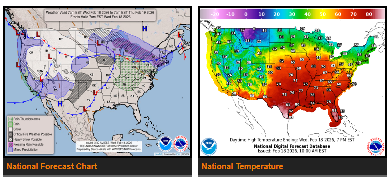
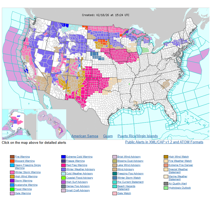
Widespread heavy snow continues across the Sierra Nevada and the mountains of the Intermountain West.
A broad area of wintry weather is expected from the Upper Midwest to New England. Another storm system will bring snow to parts of the northern and central Plains Wednesday into Thursday.
Temperatures will remain well above average across the central and eastern U.S. through mid-week, while the western U.S. stays cooler and below average.
An active weather pattern continues in the West as multiple disturbances move into the Pacific Northwest and northern Rockies. A frontal system crossing the Northwest on Wednesday will bring significant moisture, supporting widespread precipitation. Heavy snow is likely across the Cascades, Sierra Nevada, and Rockies, with the highest chances for more than 8 inches across the southern Cascades and southern Oregon coastal ranges.
Precipitation will gradually decrease in the Pacific Northwest and Intermountain West late Thursday as a ridge begins to build. However, another disturbance will keep heavy mountain snow going in the Sierra through Thursday, spreading into the Four Corners region through Friday. Rain and snow showers will continue across much of the West through Thursday, with lingering precipitation over Nevada, the Four Corners, and parts of California into Friday.
Across the Plains, a cold front will move south and east Wednesday, bringing a wintry mix from the northern and central Plains into the Great Lakes. Behind the front, precipitation will change to snow, with moderate snowfall expected across the northern High Plains Wednesday and northern/central Plains Thursday.
As the system pulls moisture north from the Gulf, thunderstorms will develop. The Storm Prediction Center has issued a Slight Risk for severe thunderstorms Thursday across parts of the lower and middle Ohio Valley, with threats including damaging winds and a few tornadoes. The system will then move into the Ohio Valley, Mid-Atlantic, and Northeast, bringing rain and high-elevation snow through Friday.
Meanwhile, dry conditions continue across parts of the central and southern High Plains, where gusty winds, warm temperatures, and low humidity are creating critical fire weather conditions Wednesday.
Overall, a strong weather contrast remains in place. The central and eastern U.S. will see much above-average temperatures, with parts of the central Plains and Midwest reaching the 70s — 30 to 40 degrees above normal for mid-February. Highs will generally range from the 30s and 40s across the northern tier, 50s and 60s from the Ohio Valley to the Mid-Atlantic, and 70s to 80s from the southern Plains to the Southeast.
In contrast, the West will stay cooler, with highs mainly in the 30s across the Intermountain West, 40s in the Pacific Northwest, 50s in California, and 60s in the Desert Southwest.
WYOMING
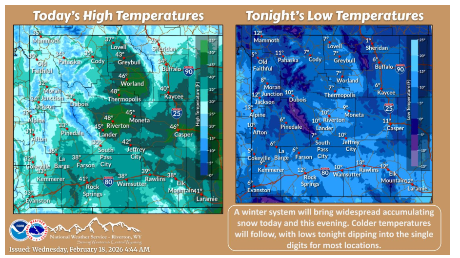
A winter system will bring widespread accumulating snow today and this evening. Colder temperatures will follow, with lows tonight dipping into the single digits for most locations.
NEBRASKA
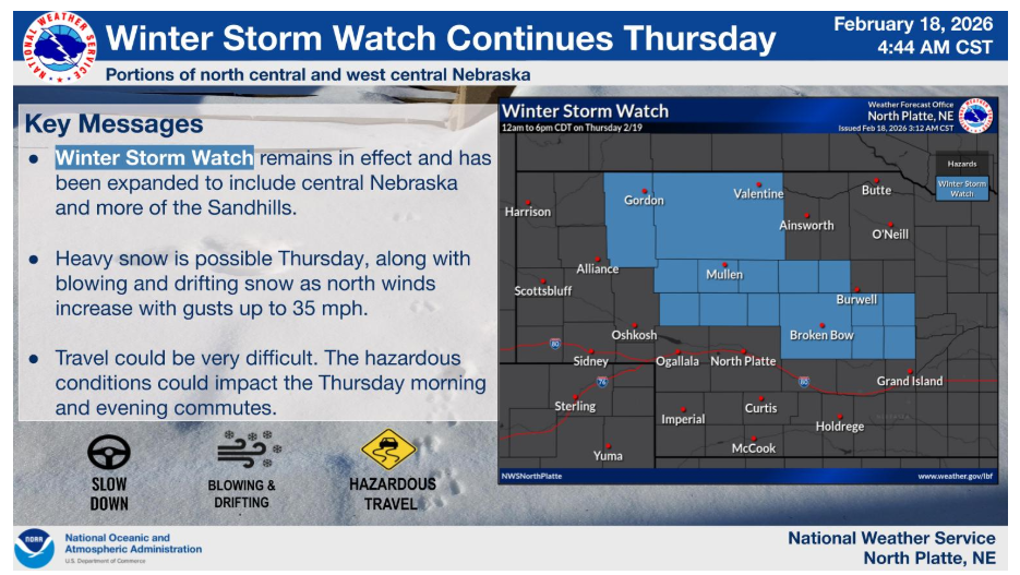
Winter Storm Watch remains in effect for Thursday. Accumulating snow, along with blowing and drifting snow, is looking more likely. Therefore, the watch has been expanded to include more of the Sandhills and central Nebraska.
Have a nice and safe day.