
West Coast
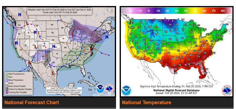
California will see a short break from the recent active weather pattern. High pressure will bring cool, dry conditions through tomorrow. However, more rain and mountain snow are expected to return Sunday into Northern California and the Pacific Northwest, with additional precipitation possible Tuesday–Wednesday next week.
Below-average temperatures will continue from the West Coast through the Great Basin, Rockies, and into the Central and Northern Plains.
Central & Southern Plains
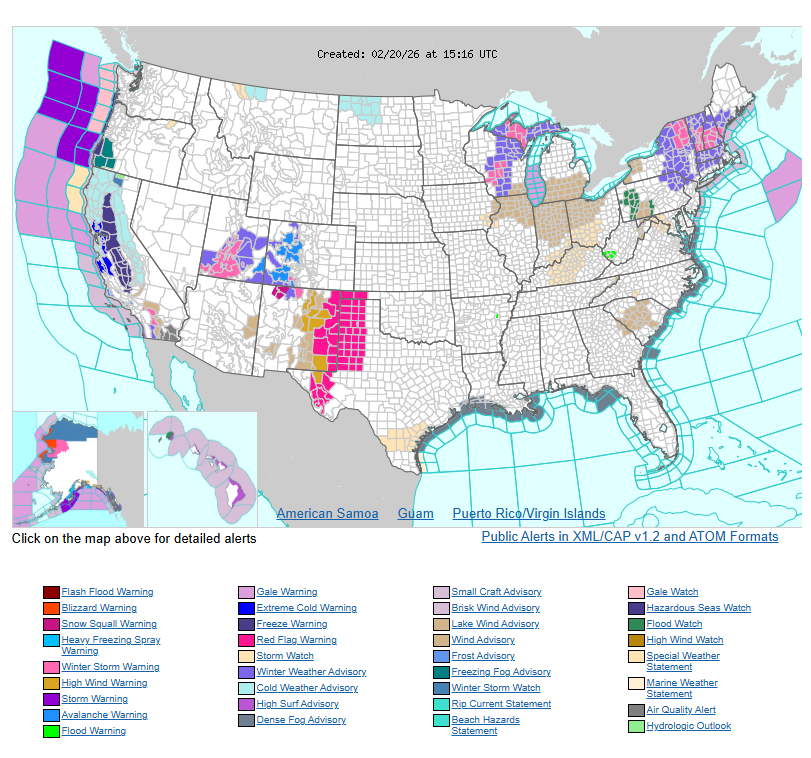
An elevated to critical fire weather threat remains in place across the Southern High Plains due to warm temperatures and low humidity.
Midwest & Upper Great Lakes
A strengthening storm system will bring heavy snow to portions of the Central Plains, Upper Mississippi Valley, and Upper Lakes through this morning. Winter Storm Warnings are in effect in several areas.
Northeast & New England
Wintry weather will spread into the Interior Northeast and northern New England late this morning, with heavy snow possible in higher elevations. Northern New York and parts of northern New England could see significant snowfall.
Eastern U.S.
Much of the South and East will remain above average in temperatures through Saturday, with some near-record highs possible in the Southeast. Rain, and possibly a rumble of thunder, is expected along parts of the East Coast today.
Looking ahead to later this weekend, a developing coastal low may bring additional wintry weather to parts of the Mid-Atlantic and Northeast. There is still uncertainty with this system, so continue to monitor updates.
WYOMING
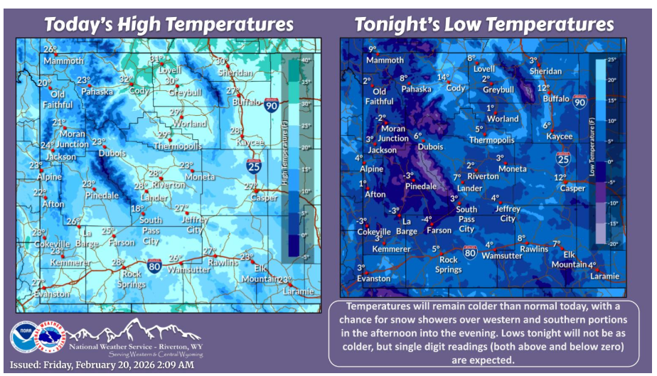
Cold conditions will continue today, albeit a few degrees warmer. Snow showers will be possible over northwestern portions and southern Sweetwater County this afternoon into the evening. Little to no accumulation is expected. Frigid temperatures will return tonight as well.
NEBRASKA
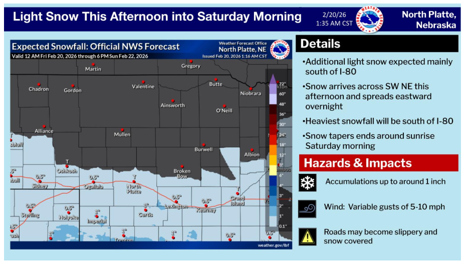
Additional light snow is possible this afternoon lasting through the overnight hours. Heaviest snowfall will be south of I-80 where up to around an inch inch is possible. Snow is expected to end by sunrise Saturday morning.
After cold temperatures this weekend, temperatures will begin to warm Monday. By Tuesday, high temperatures will reach into the 60s. There is a threat for light snow across southwestern Nebraska this afternoon into Saturday morning.
Have a nice and safe day.