
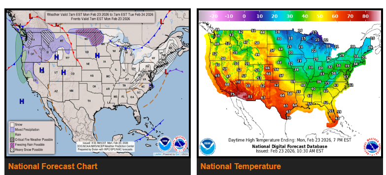
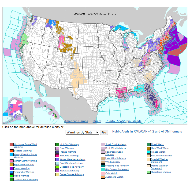
A major Nor’easter is underway along the East Coast this morning. The storm is rapidly intensifying off the Delaware and New Jersey coastline, showing a classic “comma-head” shape on satellite. The forecast remains on track.
Very heavy snowfall rates of 2–3 inches per hour and strong wind gusts of 40–70 mph will continue across the Northeast today, spreading into New England. By tomorrow morning, some coastal areas could see storm totals of 1–2 feet of snow as the system moves into the Canadian Maritimes. Travel will be nearly impossible today from the DelMarVa Peninsula through southeastern New England due to intense snowfall and damaging winds.
After this storm moves out, another system dropping out of the Upper Great Lakes may bring additional snowfall to parts of the Northeast later this week.
Meanwhile, on the West Coast, a series of atmospheric rivers will continue bringing heavy rainfall to the Pacific Northwest and into north-central California through midweek. With recent rainfall saturating the ground, isolated to scattered flash flooding is possible, especially across portions of north-central California and the Sierra Nevada. As the system shifts east, rain and mountain snow will spread into the Great Basin, helping improve drought conditions.
WYOMING
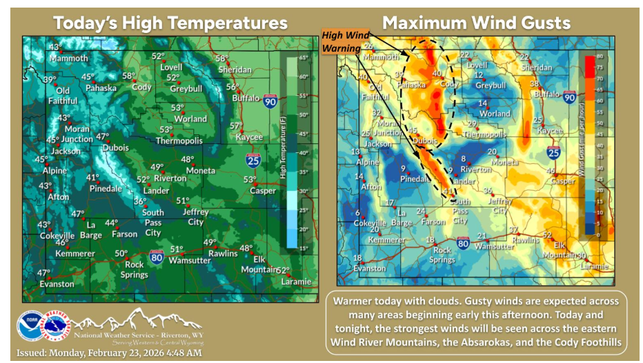
Temperatures will be warmer today. Winds begin to increase across many areas early this afternoon, with the gustiest locations being the eastern Wind River Mountains, the Absarokas, and the Cody Foothills. High Wind Warnings will be in effect for these locations beginning as early as this afternoon.
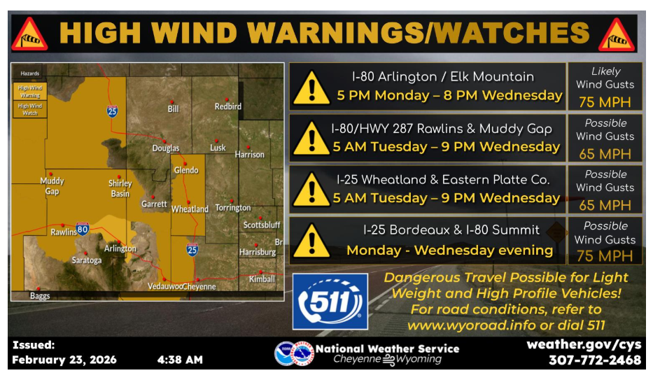
High Wind Watches have been extended to include most of Carbon and Platte Counties, and portions of Albany County Tuesday through Wednesday. Arlington/Elk Mountain area has been upgraded to a High Wind Warning starting early this evening for gusts of 65 to 75 MPH.
Have a nice and safe day.