
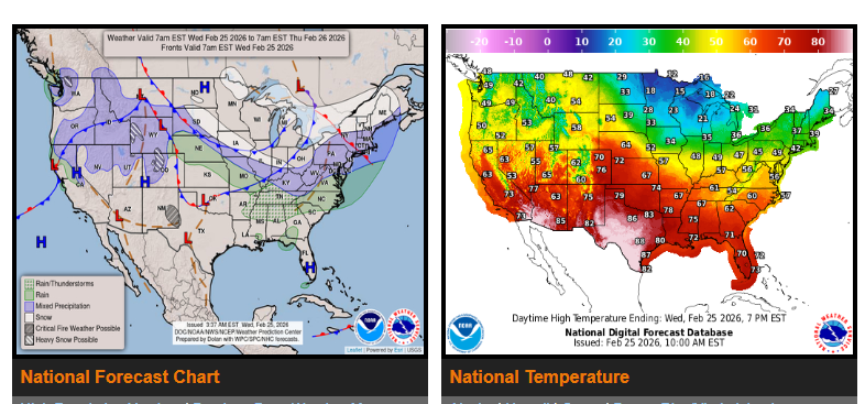
A series of clipper systems will bring additional snowfall across parts of the Central and Eastern U.S. over the next few days. The first system is moving through the Northeast and New England today, bringing light snow and some lake-effect snow. Most areas will see minor accumulations, but drivers should stay alert, especially in areas recently impacted by heavy snow.
Another system later this week may bring light snow to the Northern Rockies and Northern Plains, but impacts look limited at this time.
In the Southeast and Mid-Atlantic, showers and thunderstorms are expected tomorrow as a cold front moves through. While rain will help drought conditions, wet roads and reduced visibility may affect travel.
Out West, conditions are improving. Dry weather is expected, along with much warmer temperatures spreading across the West, Plains, and Southeast. Parts of Arizona and Southern California could see highs above 90 degrees.
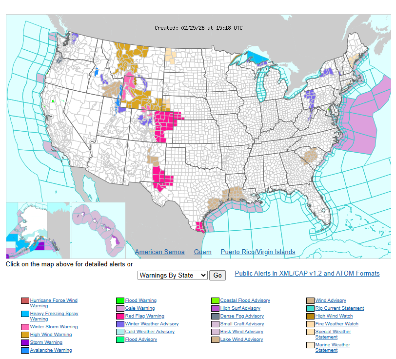
With the warmer temperatures, low humidity, and gusty winds, critical fire weather conditions are expected today across the Southern High Plains. Red Flag Warnings are in effect in some areas.
Please plan accordingly, check conditions along your route, and drive safely.
WYOMING
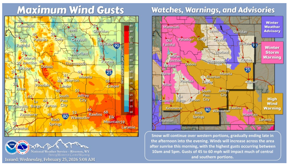
Snow will be ongoing over the western mountains through the day, ending this evening. Winds will be on the increase through the morning after sunrise. Strong to high winds, gusts of 45 to 60 mph, will be widespread across central and southern portions. Winds will decrease this evening for most areas, with gusts up to 35 mph continuing over southern portions late in the night.
NEBRASKA
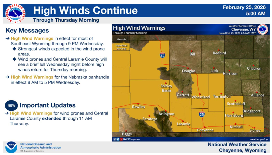
High Wind Warnings continue for southeast Wyoming and western Nebraska until 9PM tonight. Arlington, Bordeaux, the I-80 Summit, Foothills, and central Laramie County have been extended through 11 AM Thursday, but a brief lull is possible tonight into very early Thursday.
The Winter Weather Advisories for the mountains have been upgraded to Winter Storm Warnings until 5 PM this evening. Many mountain locations were around 8 to 10 inches as of 1AM this morning, with 8 to 12 additional inches possible. Highest accumulations expected to be in the peaks.
Have a nice and safe day.