
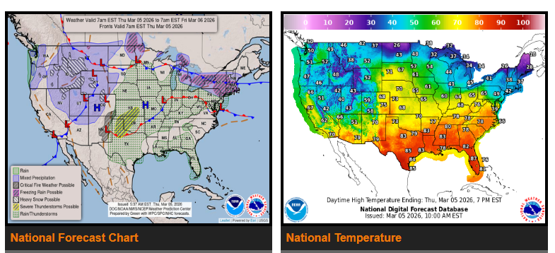
Severe thunderstorms are expected today across West Texas, Oklahoma, southern Kansas, and parts of the central Plains, with storms spreading toward the Midwest on Friday. Some storms may produce heavy rain, strong winds, and possible flash flooding.
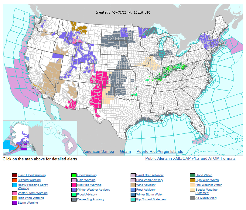
High fire danger is expected in eastern New Mexico and the Texas Panhandle due to strong winds and very dry conditions.
Winter weather will impact the central and northern Rockies, including Colorado, Wyoming, and Montana, with 6–12 inches of snow in higher elevations and possible travel impacts.
Temperatures will be well above average across the Great Plains and much of the eastern U.S., with some areas seeing temperatures 20–30°F above normal.
In central New England, a mix of snow, sleet, and freezing rain is expected late tonight into early Friday, especially across interior New York and Massachusetts, which may create icy conditions.
WYOMING
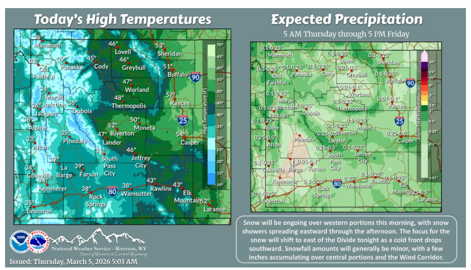
Light snow will be ongoing over western portions this morning, with snow showers spreading eastward through the afternoon as a weak cold front move through. Snow chances will increase east of the Divide tonight, as a stronger cold front drops southward. Accumulations will generally be minor, with a few inches expected over central portions and the eastern half of Sweetwater County.
The first cooler front pushes through overnight tonight into Thursday morning, but the colder air comes in Friday behind another front morning. More seasonable for this time of year but a slow warming trend for the weekend and into next week once again.
Have a good and safe day.