
Severe Weather – Midwest & Plains (Tuesday)
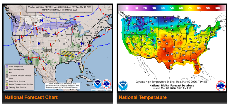
Widespread showers and thunderstorms are expected across the Midwest and central/southern Plains on Tuesday. Some storms may become severe with the potential for large hail, damaging winds, and a few tornadoes. Heavy rain may also lead to localized flash flooding.
Storm Risk Areas
- Great Lakes / Missouri Valley: Enhanced risk for severe storms including large hail, damaging winds, and possible tornadoes.
- Southern Plains (especially West Texas): Slight risk for storms capable of hail, strong winds, and isolated tornadoes.
- Flash Flooding: Possible where storms cluster and produce heavy rainfall.
Storm chances will continue into Wednesday, with additional severe weather possible from the Ohio Valley through the Lower Mississippi Valley.
Winter Weather – Northern U.S.
North of the front, wintry precipitation is expected from the Northern Plains to the Upper Great Lakes Monday through Wednesday. Light to moderate snow and ice accumulation is most likely in the Upper Great Lakes. Some wintry weather may reach northern Maine on Wednesday.
Pacific Northwest & Northern Rockies
An active weather pattern will continue bringing:
- Rain in coastal and valley areas
- Heavy mountain snow, increasing through midweek
- Another stronger system arriving Wednesday with heavier snowfall.
Fire Weather – High Plains
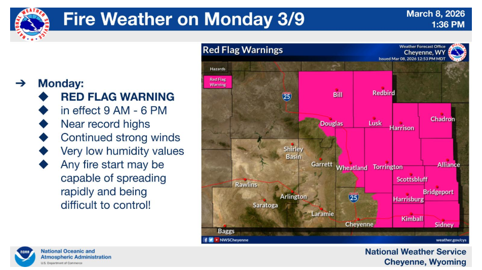
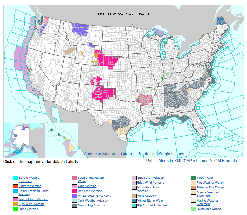
Warm, dry, and windy conditions may create critical fire weather conditions across parts of the northern and southern High Plains Monday, with elevated fire risk continuing Tuesday in the southern High Plains.
Temperatures
Much of the country will experience well above average temperatures early this week.
- Great Lakes / Midwest: Highs in the 70s, up to 25–35°F above normal, with possible record highs.
- Southern Plains to Southeast: Highs in the 70s and 80s, with some areas near 90°F.
- New England: Highs in the 50s and 60s.
- Behind the front (Northern Plains/Midwest): Cooler air returns with highs in the 40s and 50s.
- West Coast / Great Basin: Generally mild with highs in the 50s–70s.
WYOMING
Have a nice and safe day.