
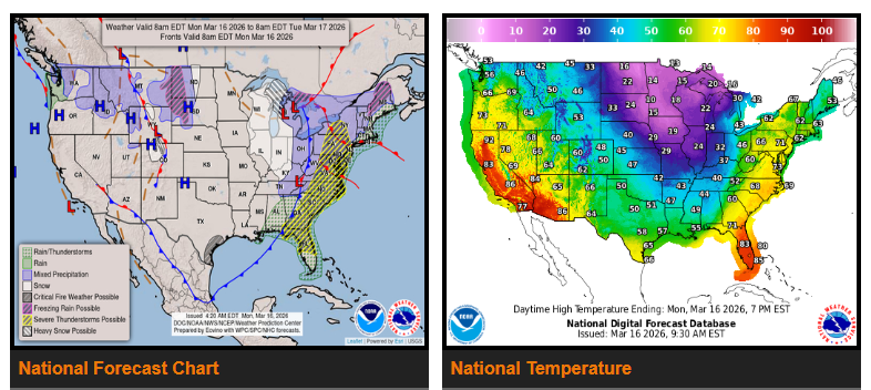
A major winter storm is continuing today across the Upper Midwest and Upper Great Lakes. Parts of Wisconsin and Michigan have already received up to 2 feet of snow, with another 12–20 inches possible in Upper Michigan today. Strong north to northwest winds will continue creating blizzard conditions and blowing snow through the day before the storm moves into Canada tonight.
Snow and blowing snow may continue across the Upper Great Lakes Monday night, with lake-effect snow lingering into Tuesday. Extremely cold wind chills are also expected in the region.
As this storm moves east, a strong cold front will sweep across the eastern United States today, bringing the potential for severe thunderstorms, especially in the interior Mid-Atlantic late this afternoon and evening. Heavy rain and thunderstorms are also possible in Florida ahead of the front.
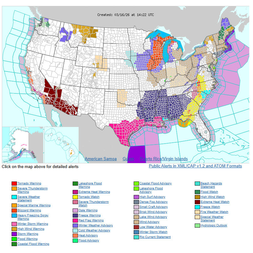
Behind the front, much colder air will move south, bringing freezing wind chills as far south as the Gulf Coast and Florida Panhandle by Tuesday morning. Freeze warnings are in effect for parts of Arkansas, Louisiana, Texas, and the Southeast. Some areas in West Virginia and the central Appalachians could see over 6 inches of snow.
Meanwhile, an unusually early heatwave is building across the Western U.S., with record or near-record temperatures expected in Southern California, the Desert Southwest, and the Great Basin over the next few days.
Rain will continue across the Pacific Northwest, mainly in northwestern Washington, through Wednesday morning, with a small chance of localized flooding.
WYOMING
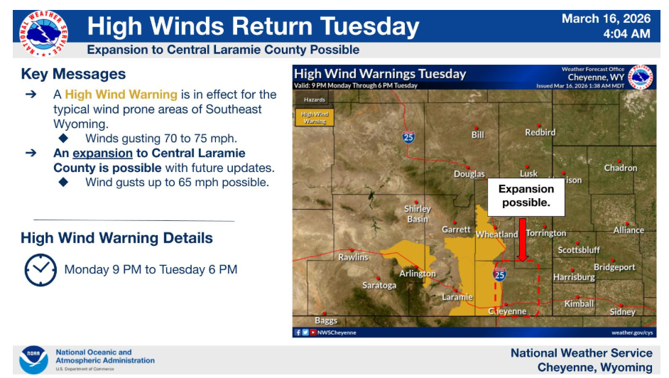
The High Wind Watches for the wind prone areas have been upgraded to High Wind Warnings from 8PM tonight through 6PM Tuesday. Wind gusts in excess of 70mph are expected. High winds may spill into wind prone adjacent areas, potentially leading to an expansion of the High Wind Warning. Stay tuned for updates.
Have a nice and safe day.