
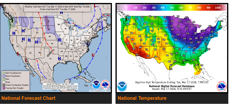
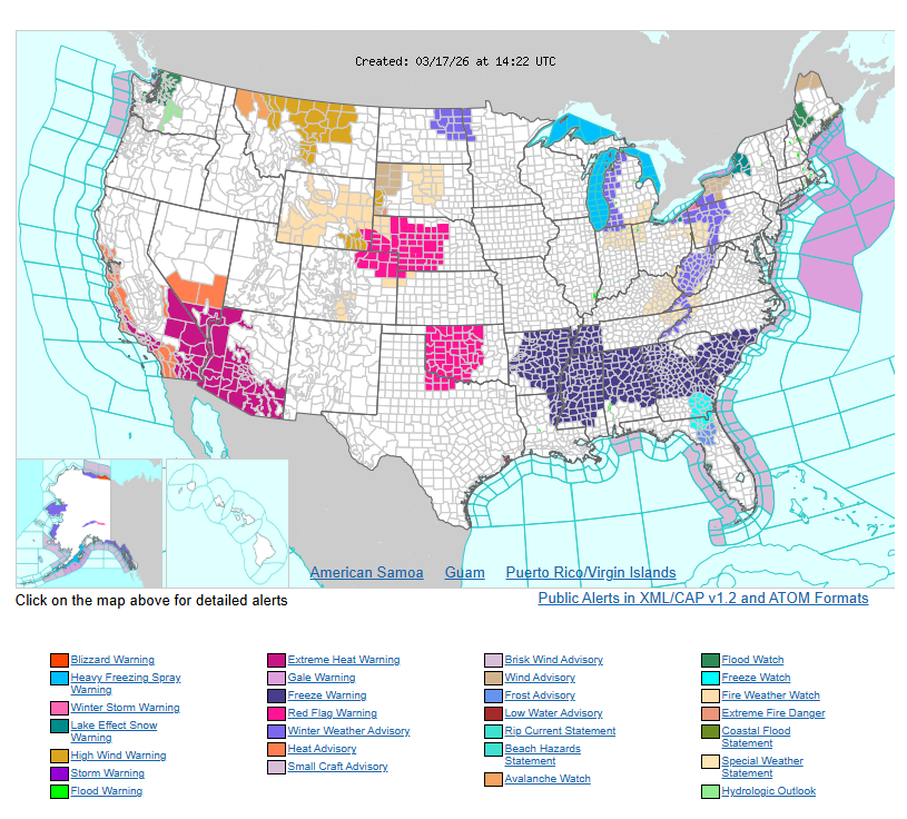
An early heatwave is building across the western U.S. and will continue expanding east over the next few days. Temperatures will climb into the 100s across the Desert Southwest, with some areas seeing record-breaking heat.
Cold air behind a recent storm is bringing freezing conditions across parts of the South this morning, shifting into the Southeast by Wednesday. Some areas may still see near-record low temperatures.
In the Northeast, a strong storm system is moving out, but gusty winds will continue through today before calming down tonight. Lake-effect snow will gradually taper off.
Light snow is moving through the northern Plains today and into the upper Midwest by Wednesday.
The Pacific Northwest, especially Washington, will remain wet with steady rain and mountain snow over the next couple of days. Some areas could see heavy rainfall.
Overall, after the current storm exits, much of the country will see quieter weather, with warming conditions spreading from the West into the central U.S.
WYOMING
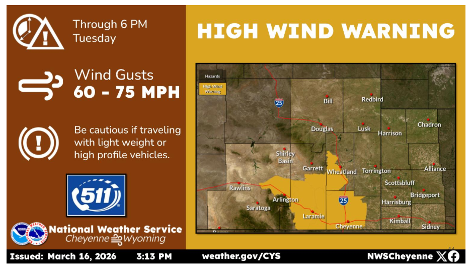
A High Wind Warning has been issued for portions of southeastern Wyoming on Tuesday from Arlington to Cheyenne and up to Bordeaux. Wind gusts of 60-75 mph are expected through Tuesday evening.
Have a good and safe day.