
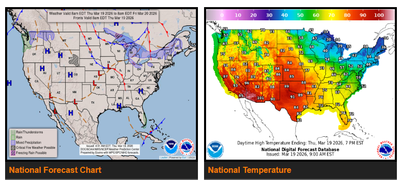
An early, record-breaking heatwave continues to intensify across the Western U.S. and is expanding into the Great Plains.
Wet conditions persist in Western Washington, while a wintry mix is expected across the Upper Midwest, Great Lakes, and Interior Northeast.
A Critical Fire Weather Risk remains in place across parts of the central and northern High Plains.
A strong high-pressure system over the West will continue to build and push east this week, bringing summer-like temperatures. Highs will reach the 80s and 90s from California through the Great Basin, Rockies, and into the Plains, with triple-digit temperatures in Southern California and the Desert Southwest. Numerous daily and monthly March heat records are expected, with some already broken.
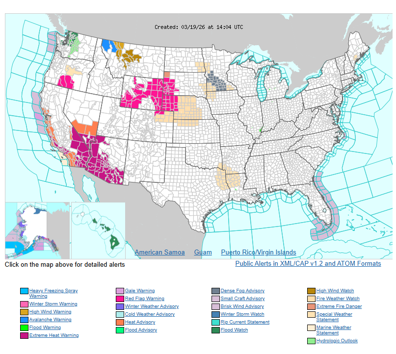
This prolonged and early heat increases the risk of heat-related impacts, especially for those without proper cooling. Heat advisories and warnings are in effect across the Desert Southwest and parts of central and southern California.
Rapid snowmelt is also a concern, which may lead to rising rivers and dangerous currents. Despite warm air temperatures, water remains very cold, creating a risk of cold water shock and hypothermia.
The heat will continue spreading into the Plains through the weekend, with temperatures climbing into the 80s, 90s, and even triple digits. Meanwhile, the eastern U.S. will begin warming up after a cold start to the week, bringing more spring-like conditions by the weekend.
A persistent atmospheric river will bring periods of moderate to heavy rain to the Pacific Northwest through Saturday, with a risk of localized flooding, especially in higher terrain. Snow will be limited to higher elevations.
Two weak systems will bring a mix of rain and snow across the Upper Great Lakes into the Interior Northeast through Friday. Some showers and thunderstorms are also possible in the Ohio Valley, Mid-Atlantic, and New England.
Across the High Plains, dry conditions combined with gusty winds will continue to elevate fire danger. A Critical Fire Weather Risk remains in effect, especially in eastern Wyoming, where Red Flag Warnings are active.
WYOMING
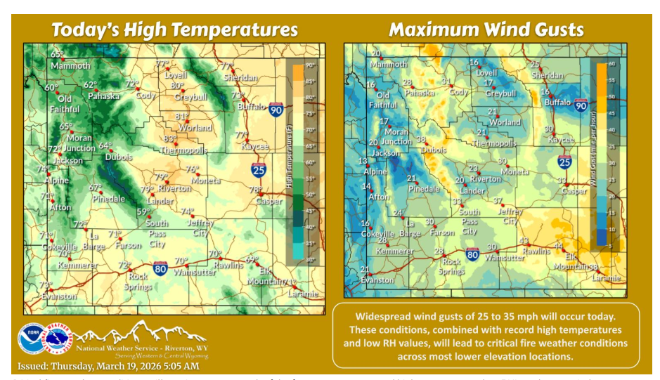
Critical fire weather conditions will continue across much of the forecast area, as record high temperatures, low RH’s and gusty winds return today.
Have a nice and safe day.