
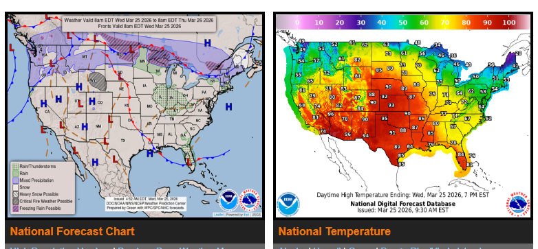
A record-breaking heat wave is spreading from the Southwest into the Plains, Midwest, and Southeast.
Temperatures will run 25–35 degrees above normal, with highs in the 90s across the central and southern Plains into the Mid-Mississippi Valley. Peak heat is expected today through Thursday, with slightly cooler conditions by Friday, though the Southeast may still see near 90°.
A strong cold front will move across the country from tonight through Friday, bringing relief from north to south. Behind it, much colder air will settle in, with below-average temperatures expected across much of the central and eastern U.S. by Friday into Saturday.
Additional Impacts:
- Northern Rockies & Cascades: Snow possible, with several inches in higher elevations
- Plains to Mid-Atlantic: Showers and thunderstorms developing Thursday
- Midwest & Ohio Valley (Thursday): Risk of severe storms, including large hail, strong winds, and possible tornadoes
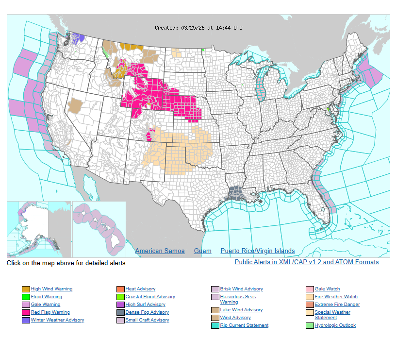
- Rockies & High Plains: Gusty winds creating elevated to critical fire weather conditions
WYOMING
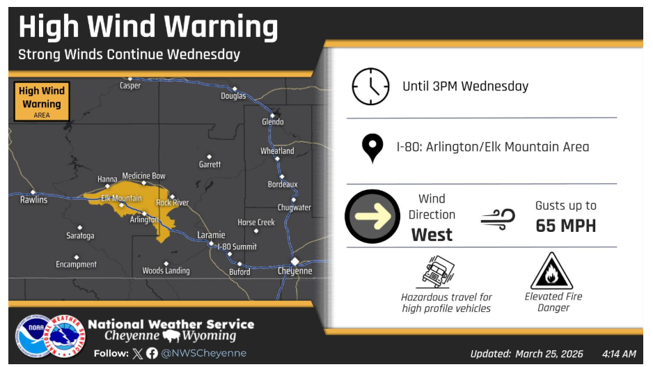
A High Wind Warning has been issued for the Arlington/Elk Mountain area along I-80 through 3PM today. Occasional gusts exceeding 60 mph will be possible.
Stay alert to changing conditions and plan accordingly.