
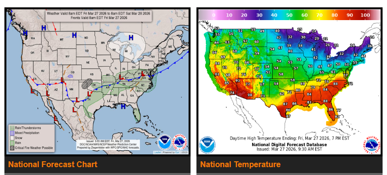
A cold front is moving through the Plains and heading east, bringing cooler temperatures across the Midwest, Ohio Valley, and Northeast. Highs will drop into the 40s–50s, with some 30s near the Great Lakes and New England.
The Southeast will stay warm Friday (80s), but cooler air arrives by Saturday, dropping temps into the 60s. Overnight lows this weekend will fall into the 20s–30s in the Ohio Valley and Mid-Atlantic, with 30s–40s in the Southeast—watch for possible frost.
Out West, warm weather continues. Expect 90s–100s in the desert Southwest and 70s–80s across the Intermountain West.
Fire Weather Alerts
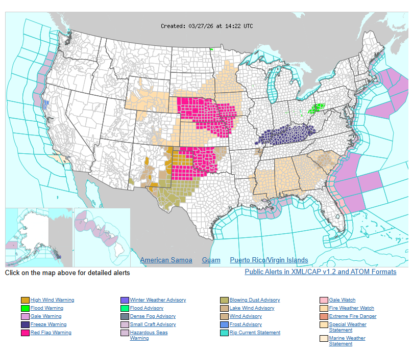
Strong winds (35–50 mph) and dry air are creating fire danger across Texas, Oklahoma, and New Mexico. Red Flag Warnings and Wind Advisories are in effect. Parts of the Southeast may also see fire risk.
Rain/Storms
Scattered showers and storms are possible today in the Tennessee Valley and Mid-Atlantic.
Florida will see showers and storms this weekend as the front stalls there.
Outlook
Most of the country will stay dry this weekend. Warmer temperatures will start returning to the Plains by late weekend.
WYOMING
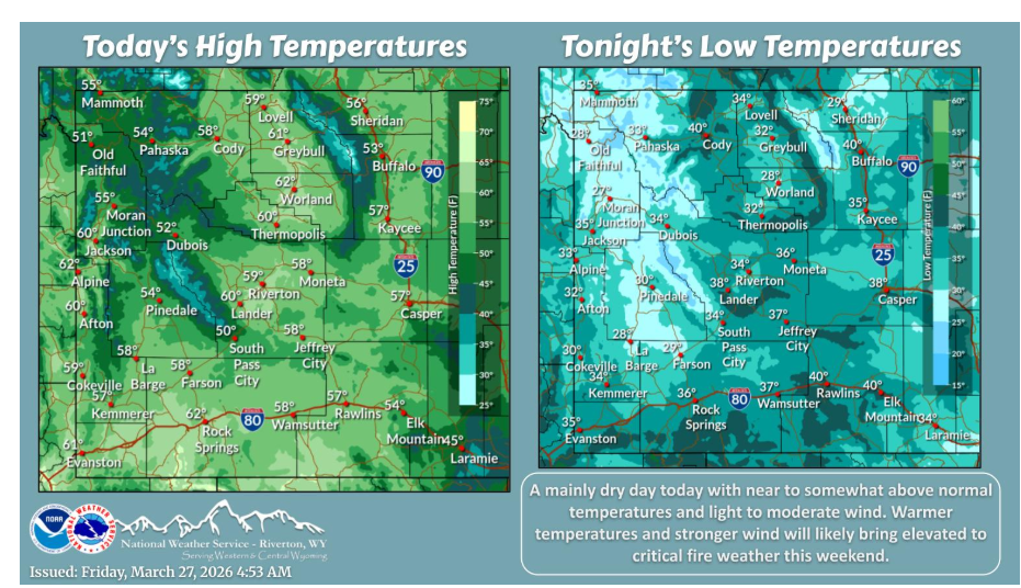
A dry day with light to moderate wind and temperatures near to somewhat above normal. Increasing wind and warmer temperatures bring a return of elevated to critical fire weather this weekend.
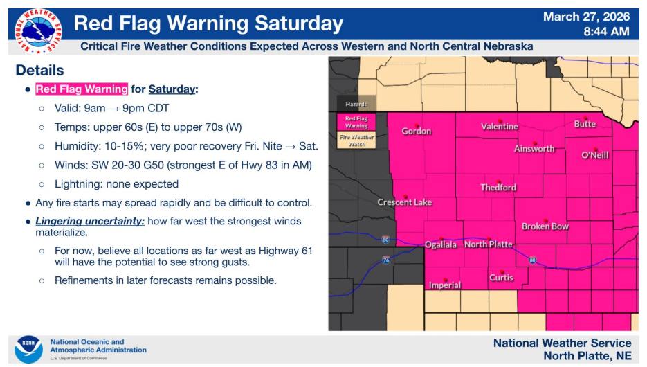
A Red Flag Warning is in effect Saturday for much of western and north central Nebraska from 9 AM to 9 PM CDT. Expect very dry air (humidity as low as 10–15%) and strong southwest winds gusting up to 50 mph. Any fires that start will spread rapidly and be difficult to control. There is still some uncertainty on how far west the strongest winds develop, but areas as far west as Highway 61 could still see strong gusts. Avoid activities that could spark a fire.
Have a nice and safe day.