
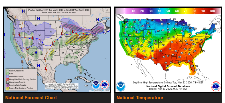
Rain and some freezing rain are expected from the Upper and Middle Mississippi Valley into the Northeast.
Severe thunderstorms will impact parts of the Great Lakes and Ohio Valley on Tuesday, then shift into the Central and Southern Plains on Wednesday.
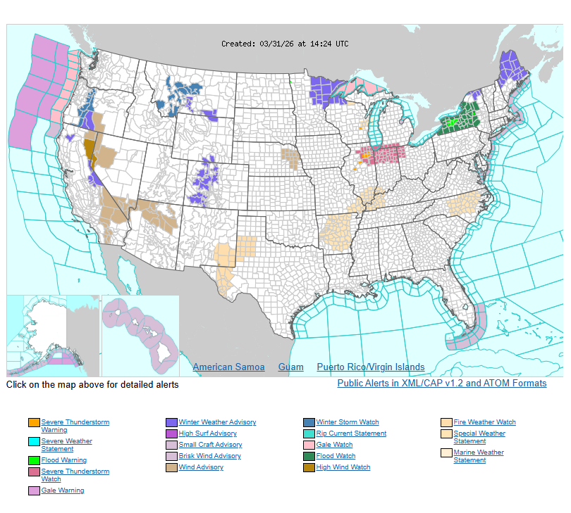
A slow-moving front stretching from the Northeast through the Great Lakes and into the Plains and West Coast will bring multiple rounds of unsettled weather through Thursday. Along this system, showers and severe thunderstorms are expected in the Great Lakes and Ohio Valley, with risks including strong winds, hail, frequent lightning, and a few tornadoes.
Additional storms will develop across the Middle Mississippi Valley, Southern Plains, and parts of the Gulf Coast. At the same time, areas from the Upper Midwest into the Northeast may see a mix of rain and freezing rain, with light snow possible in northern areas like northern Maine and parts of the Northern Plains.
By Wednesday, storms will expand from the Mid-Atlantic back into the Mississippi Valley, with the greatest severe weather risk across the Central Plains into the Southern Plains. These storms may again bring strong winds, hail, lightning, and isolated tornadoes. Rain and freezing rain will also continue from the Plains to the Great Lakes and parts of the Northeast, with light snow in portions of the Northern and Central Plains.
Out West, a new system will bring rain to the Pacific Northwest and California starting Tuesday, spreading inland by Wednesday and Thursday. Higher elevations will see snow, including the Northern Rockies, Great Basin, Central Rockies, and the Sierra Nevada.
Have a nice and safe day.