
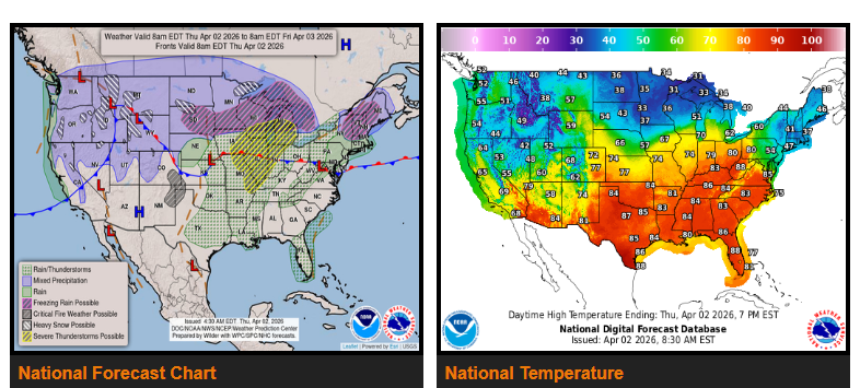
Severe thunderstorms are expected across the Upper and Middle Mississippi Valley and into the Great Lakes Thursday through Friday, bringing strong winds, hail, heavy rain, and the possibility of tornadoes.
Rain will spread from the Ohio Valley into the Northeast, creating wet and slick driving conditions.
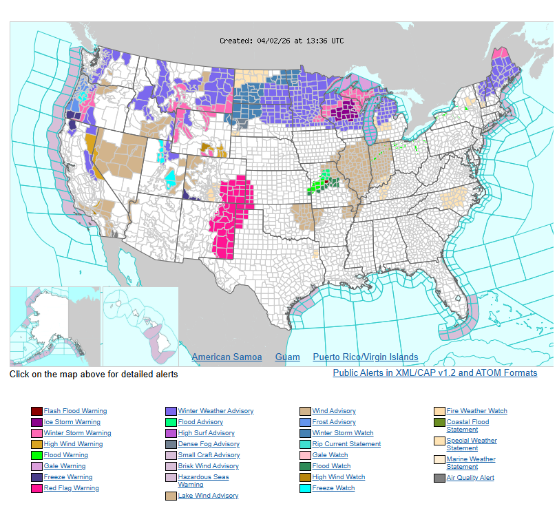
A winter storm is impacting the Northern Plains and Upper Midwest, including North Dakota, Minnesota, Wisconsin, and Michigan. Expect heavy snow of 3–6+ inches, along with sleet and freezing rain. Ice accumulation may reach up to a quarter inch or more in some areas, leading to dangerous roads, reduced visibility, and possible power outages.
A second system will move in Friday into Saturday, bringing another round of snow and ice to the Northern Plains, along with additional severe thunderstorms across the Mississippi Valley.
Please slow down, increase following distance, watch for black ice in northern areas, and stay alert for rapidly changing weather conditions. Plan ahead and allow extra time where needed.
WYOMING
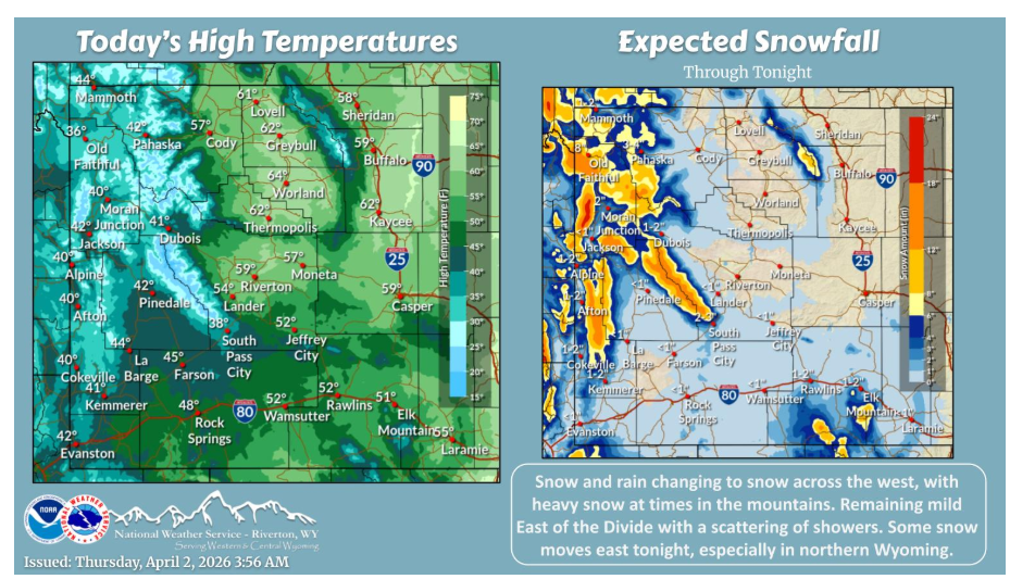
A weather system brings snow and rain changing to snow across western Wyoming today. Scattered rain showers occur East of the Divide today, with some snow moving in tonight and Friday, mainly in northern Wyoming.
Have a nice and safe day.