
An active weather pattern is expected across much of the U.S. over the next couple of days, bringing a mix of heavy snow, rain, and severe storms.
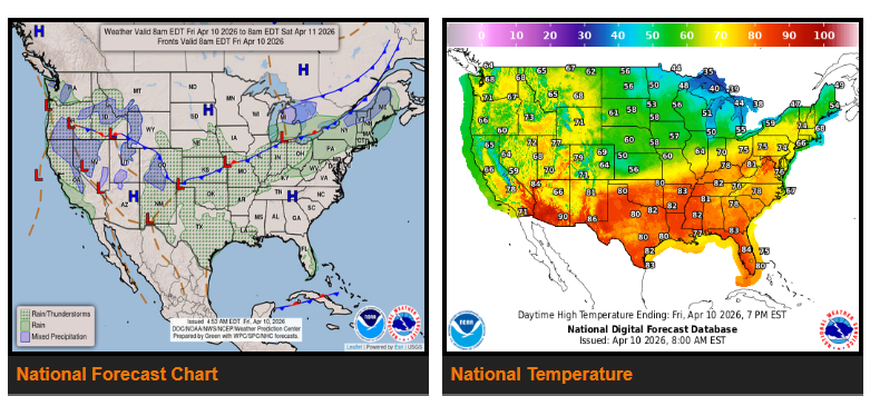
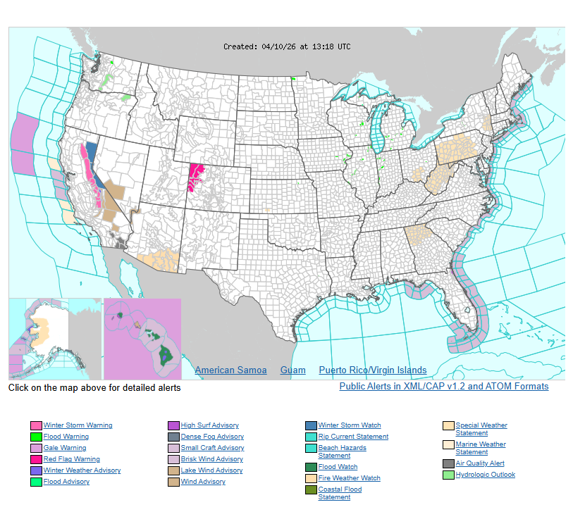
Out west, California will see the most impact as two Pacific storm systems move inland back-to-back. The Sierra Nevada is expected to receive several feet of snow, while lower elevations could see 1–2 inches of rain. Moisture will continue pushing into the Great Basin and Rockies, bringing additional precipitation and high-elevation snow through the weekend. Temperatures in the interior West will trend warmer than normal, but California will stay cooler due to cloud cover and ongoing storms.
Across the central U.S., scattered thunderstorms with heavy rain are expected today in the Central Plains, shifting into the southern High Plains by Saturday. These storms could become strong to severe, especially later Saturday as Gulf moisture increases. Severe weather may continue into early Sunday as conditions move east across the southern Plains.
A frontal boundary stretching from the Plains to the Northeast will bring a surge of warm air across the eastern U.S., with the most noticeable warming in the Northeast. Rain is expected from the Ohio Valley into New England, followed by a cooldown over the weekend. Additional storms may develop across the upper Midwest Saturday night into Sunday morning.
Temperatures will vary significantly nationwide. Much of the central and eastern U.S. will see above-normal temperatures, with some areas 10–20 degrees warmer than usual and possible record highs by Saturday. Meanwhile, the Northern Plains will stay cooler behind a cold front. California will remain below normal due to storm activity, while parts of the Northeast and Great Lakes return closer to seasonal averages.
Have a nice and safe day.