
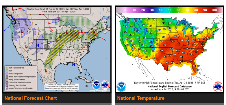
Strong to severe thunderstorms with heavy rain are expected over the Southern and Central Plains, as well as from the Upper Midwest into the Great Lakes over the next couple of days. Storms will likely develop each afternoon and evening, moving west to east, with repeated rounds possible.
In the central and southern Plains, moisture from the Gulf interacting with a dryline will bring additional rounds of strong to severe storms, especially later in the day and into the overnight hours. These storms may extend into Missouri and parts of the Midwest.
A frontal boundary across the northern U.S. will continue to trigger waves of low pressure, bringing repeated chances of storms from the Upper Midwest to the Great Lakes. The interior Northeast can also expect periods of showers and thunderstorms through today and Wednesday.
Very warm air is spreading across the eastern U.S., with temperatures climbing into the 80s and even 90s. Record-breaking heat is possible, especially across the Mid-Atlantic through Thursday.
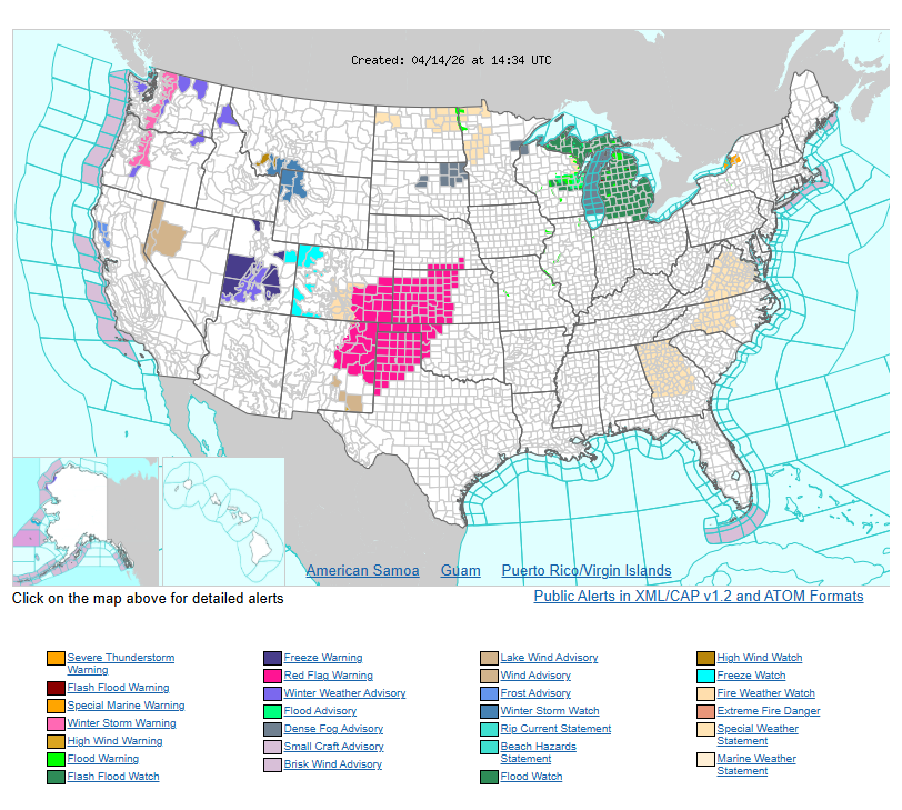
Out west, unsettled weather continues. Rain at lower elevations and snow in the mountains will move through the Four Corners and central Rockies today. A stronger system will arrive in the Pacific Northwest on Wednesday, bringing heavy mountain snow, strong winds, and much colder temperatures, reaching the northern Rockies by Thursday morning.
At the same time, parts of the central to southern High Plains and nearby southern Rockies will face critical fire weather conditions due to warm temperatures, dry air, and gusty winds.
WYOMING
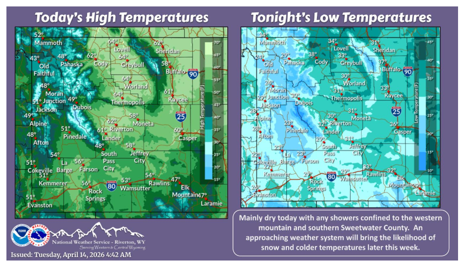
A mild day and dry day for most today with only stray showers in the west and south. A weather system will likely bring snow and colder temperatures to most of the area Thursday and Friday.
Have a nice and safe day.