
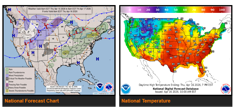
Late-season snow is expected across the Cascades, northern Plains, and northern Rockies, while much warmer temperatures continue in the Mid-Atlantic.
The severe thunderstorm threat from the southern Plains to the Midwest will decrease today. However, another round of severe weather is expected to develop Friday, bringing heavy rain and a risk of flash flooding from the southern Plains into the upper Midwest.
A cold front moving across the western U.S. will bring much colder temperatures, strong winds, and snow to the Rockies and Cascades. Parts of the northern Plains may also see rain changing to snow, along with a wintry mix in areas like North Dakota and northern Minnesota.
By Friday into early Saturday, strong to severe thunderstorms are expected from Oklahoma through the Midwest, with risks including damaging winds, hail, tornadoes, and heavy rainfall that could lead to flash flooding.
Meanwhile, the eastern U.S. will remain warmer than normal, with temperatures reaching into the 90s in some areas before gradually cooling heading into the weekend.
WYOMING
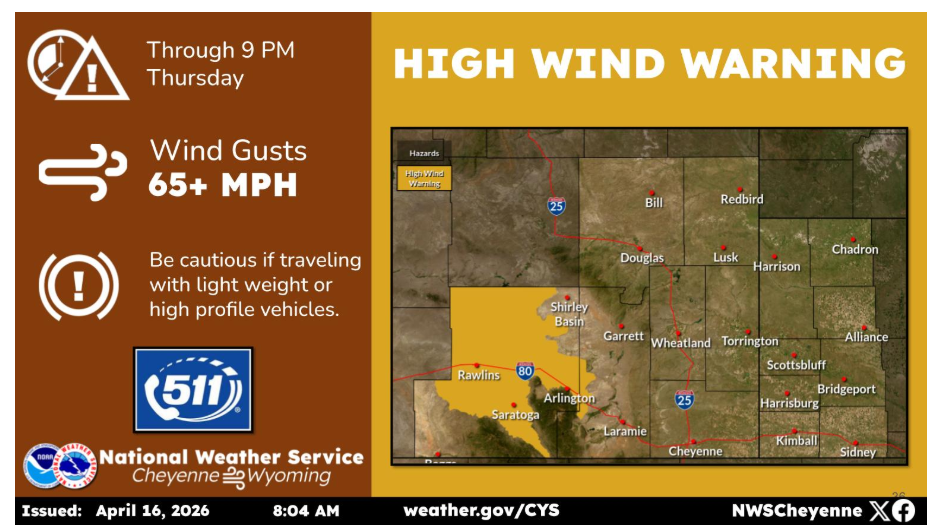
A High Wind Warning is in effect through 9 PM this evening for portions of Carbon County. Wind gusts of 65+ mph will be possible.
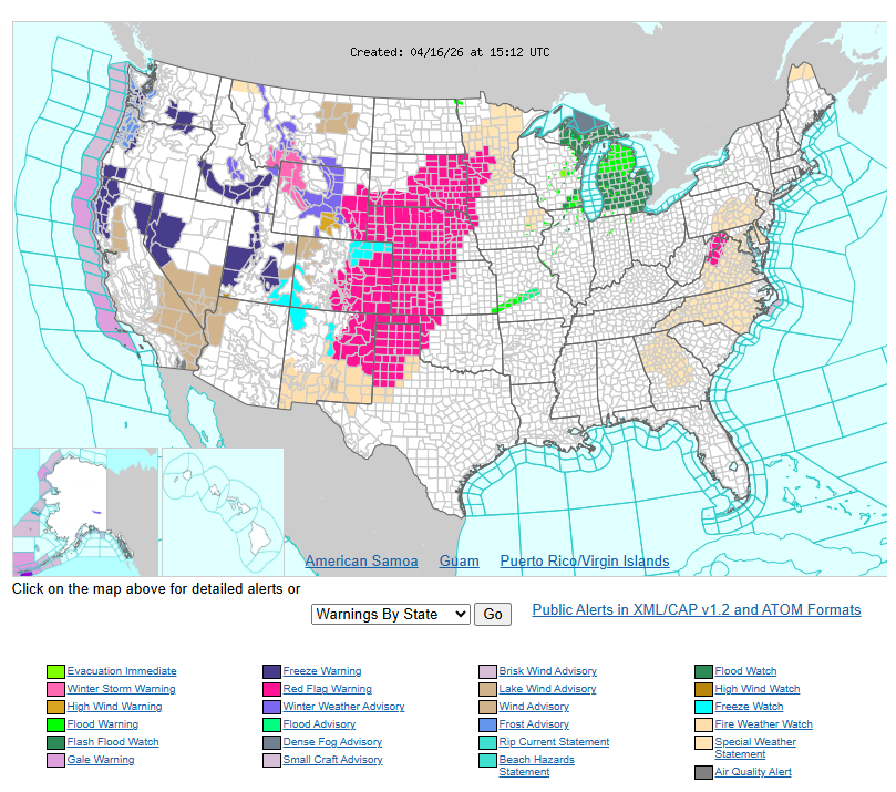
Stay alert and drive safe.