
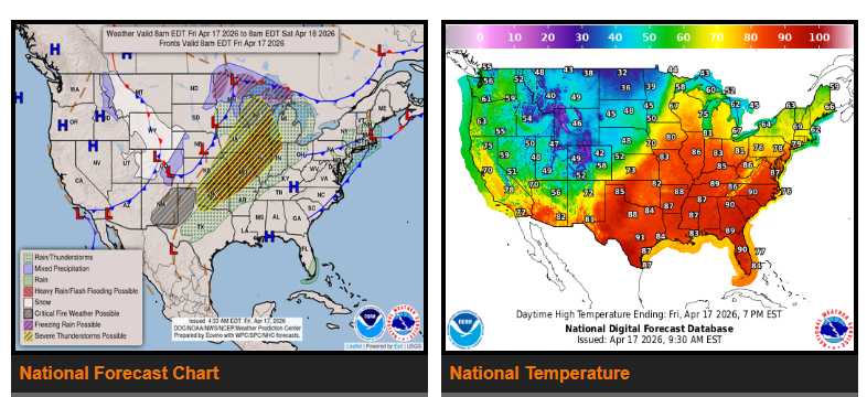
Widespread severe weather and flash flooding are expected today across much of the Midwest and central/southern Plains. Strong thunderstorms may produce very large hail, damaging winds, and tornadoes—some could be strong. The highest tornado risk is in the Upper Mississippi Valley, while large hail is more likely across the central and southern Plains.
Heavy rainfall with rates of 1–2 inches per hour could lead to flash flooding, especially from the Lower Missouri Valley through parts of Missouri, Kansas, Arkansas, and Oklahoma where the ground is already saturated.
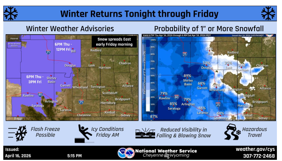
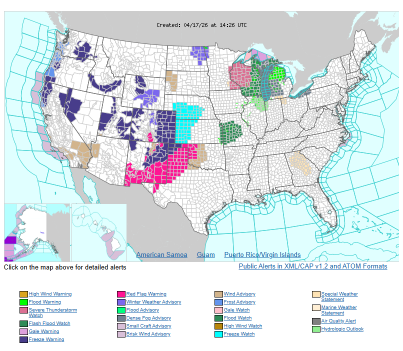
At the same time, late-season winter weather is expected across the northern and central Rockies into the Upper Midwest and Great Lakes, with areas of snow and a wintry mix.
A cold front moving through will bring an end to the above-average heat across the central and eastern U.S. Temperatures will drop significantly heading into the weekend, with much cooler conditions spreading east.
Looking ahead:
Saturday – Storms shift toward the Ohio Valley, Lower Mississippi Valley, and Texas with a lower severe risk.
Sunday – Showers and storms move into the Northeast, Mid-Atlantic, and Gulf Coast.
WYOMING
NEBRASKA
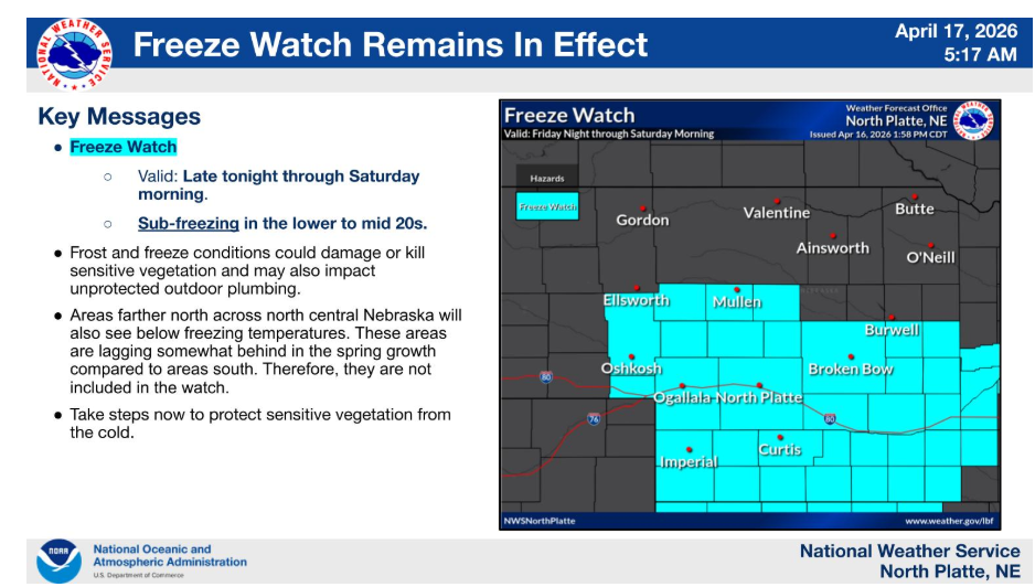
A cold night is in store across the area overnight tonight. Winds will decrease under clear skies and allow for low temperatures by Saturday morning to range from the lower to middle 20s.
Have a nice and safe day.