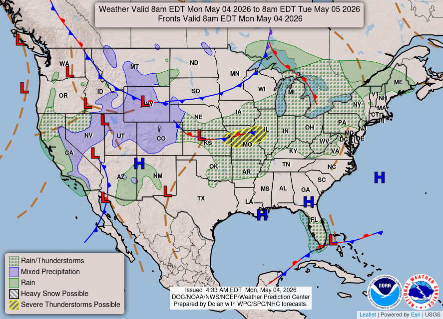
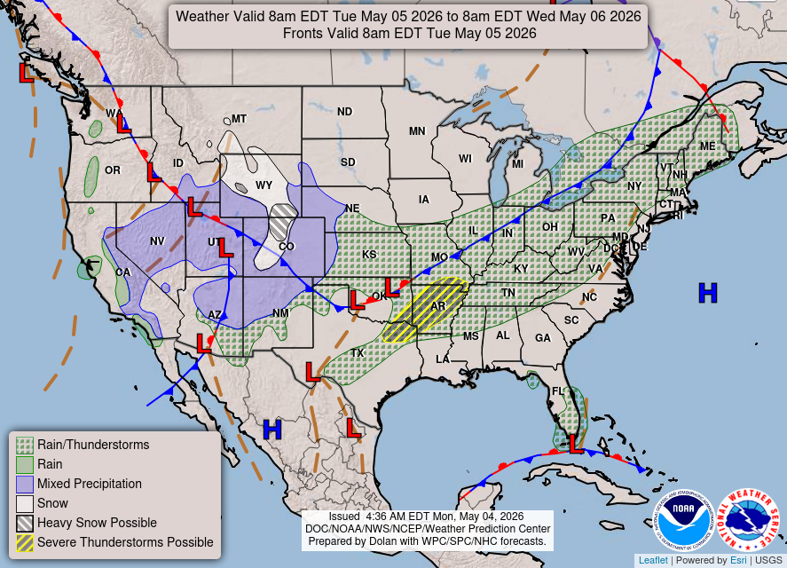
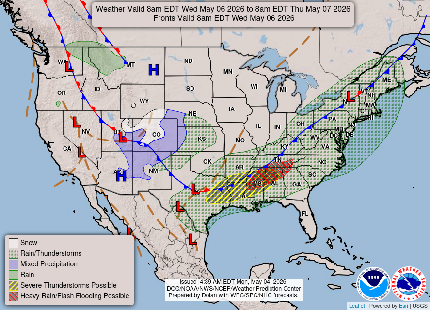
Scattered strong to severe thunderstorms are possible Tuesday and Wednesday afternoon and evening from east Texas into western Alabama. Damaging winds, large hail, and a couple of tornadoes will be possible. Excessive rainfall in this area may lead to flooding as well. Late-season snow is expected over parts of SE Wyoming and the central Rockies including the Denver Metro tonight into Wednesday.
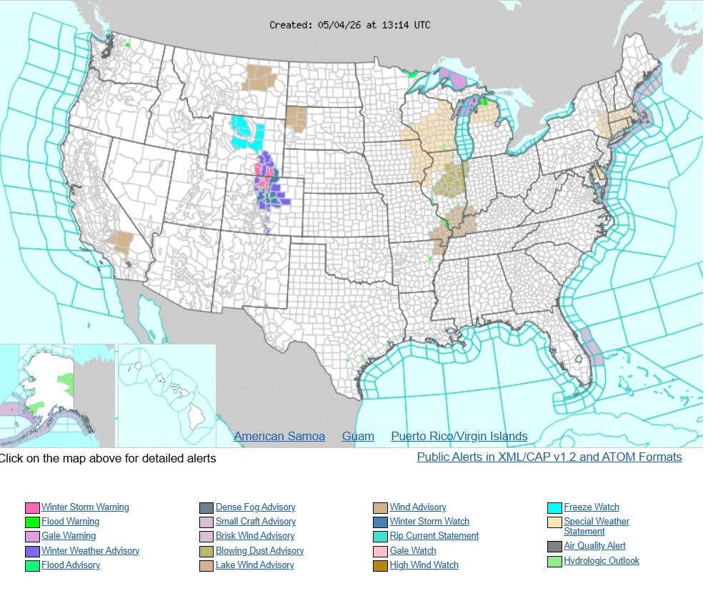
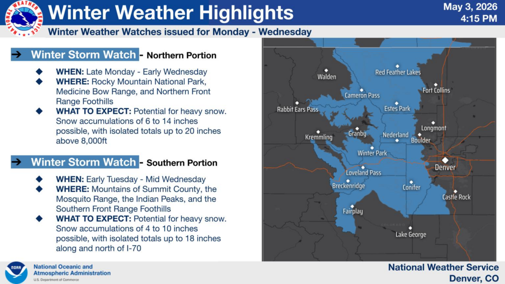
A significant late season snow event is expected to move into the area Monday night and continue through Wednesday morning. Winter Storm Warnings, Watches, and Winter Weather Advisories have been issued.
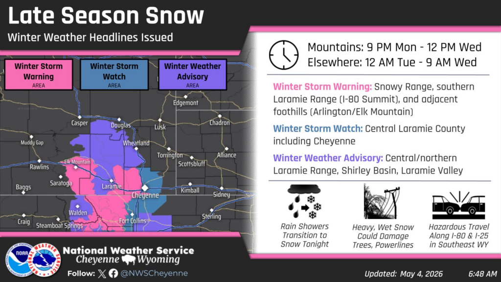
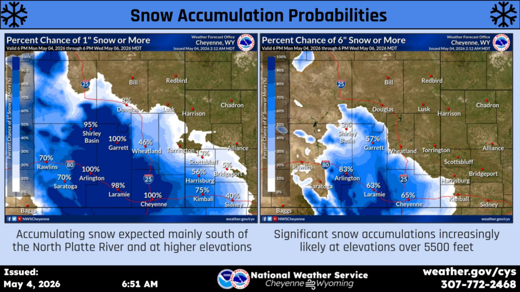
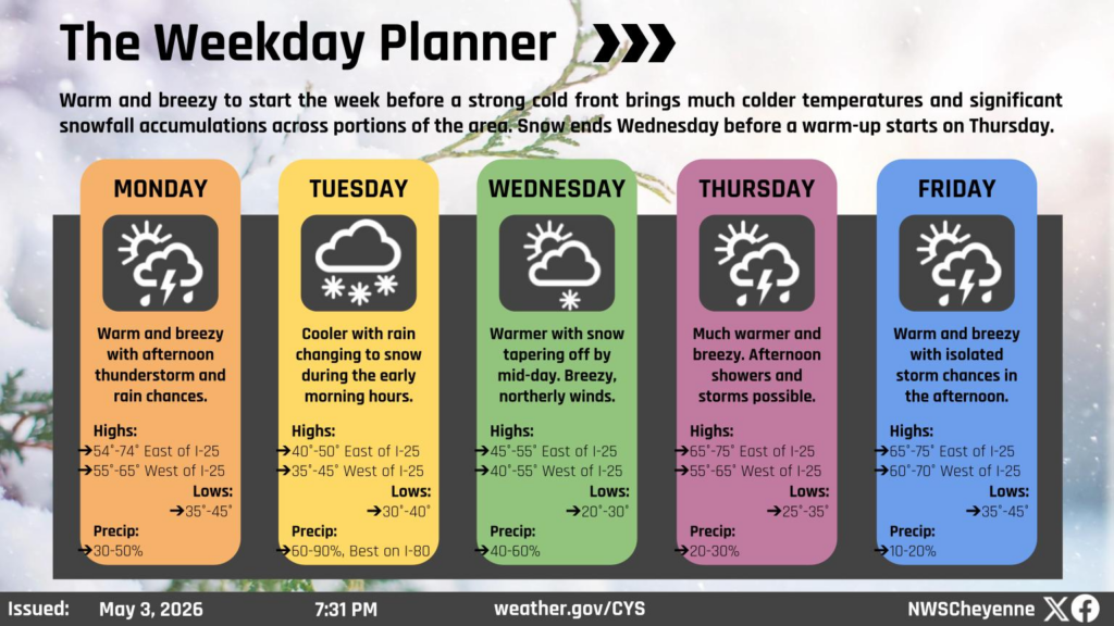
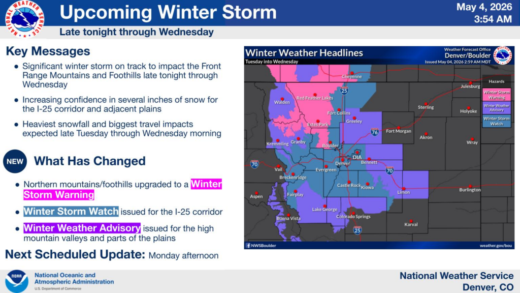
A significant winter storm remains on track to impact the Front Range of Colorado late tonight through Wednesday, with the bulk of the snowfall and impacts occurring Tuesday into Wednesday morning. Expect considerable travel impacts in the high country, especially across the northern mountains and foothills where 1 to 2 feet of snow will be widespread. Damage to tree limbs and power lines will be possible in areas that receive heavy snow. Several inches of wet snow are also expected across the I-25 corridor, high valleys, and portions of the plains, potentially impacting the Wednesday morning commute.
THREE DAY FORECAST