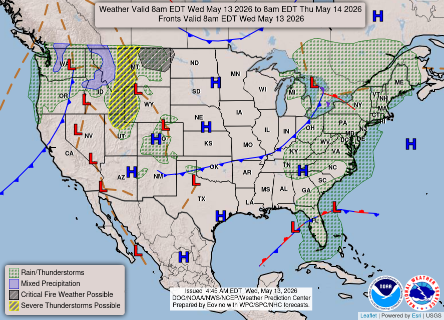
Scattered severe thunderstorms are possible across portions of the northern High Plains Wednesday afternoon and evening. Severe wind gusts are the primary hazard. Gusty winds and low relative humidity will contribute to critical fire weather conditions across parts of the northern Great Plains and Great Basin Wednesday.

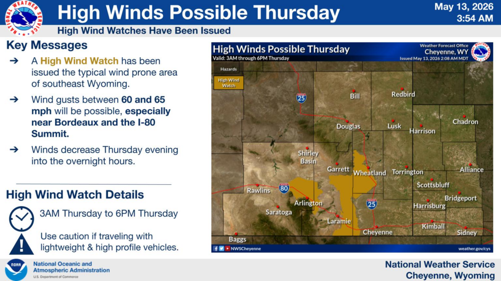
High Wind Watches have been issued for the typical wind prones area of southeast Wyoming from 3AM through 6PM Thursday. Gusts between 60 and 65 mph will be possible, especially near Bordeaux and the I-80 Summit.