
Weather Report 05/21/2025
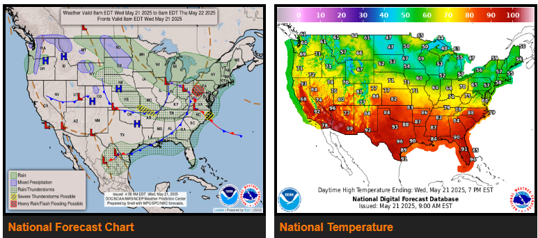
Severe Weather and Flash Flooding expected over the Ohio Valley/Mid-Atlantic today.
Above average temperatures across southern tier states and West; below average temperatures from Northern Plains to Northeast/Mid-Atlantic.
Severe storms and excessive rainfall concerns should diminish considerably across the lower 48 through mid-week. A pair of low-pressure systems moving through the Midwest and East Coast will continue to focus scattered to isolated showers and thunderstorms along its path.
Some of today’s storms could turn severe, producing large hail, strong wind gusts and a tornado or two, according to the Storm Prediction Center. SPC issued a Slight Risk (level 2/5) of Severe Thunderstorms from the Ozarks to the Mid-South and far eastern North Carolina to account for this threat.
WYOMING
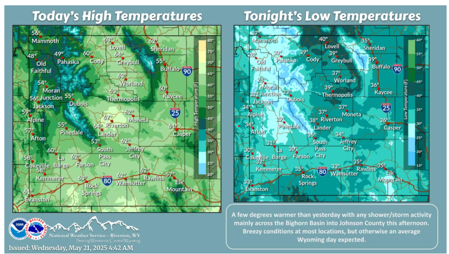
A bit warmer this afternoon with some sporadic rain showers/thunderstorms across portions of northern and north central Wyoming. Otherwise, breezy winds with another chilly night overnight into Thursday morning.
NEBRASKA
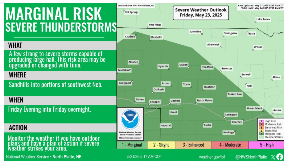
A warm front will develop across Kansas on Friday. A few strong or severe thunderstorms could develop Friday night to the north of the front. Hail would be the main severe weather threat.
Have a fantastic day.