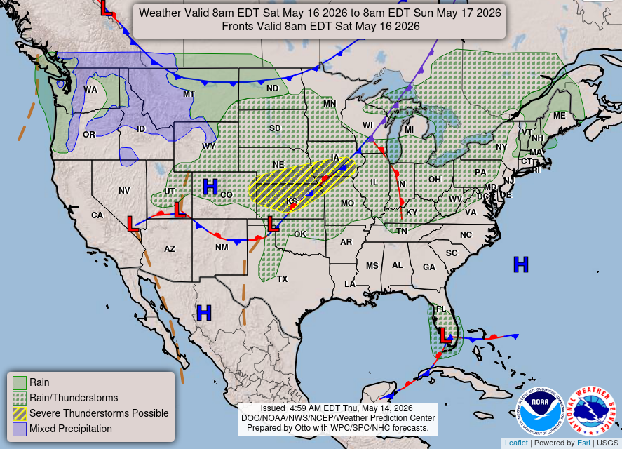
Weather Report – 05/14/2026
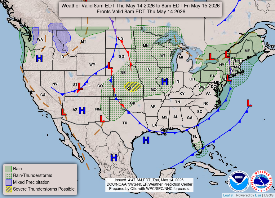
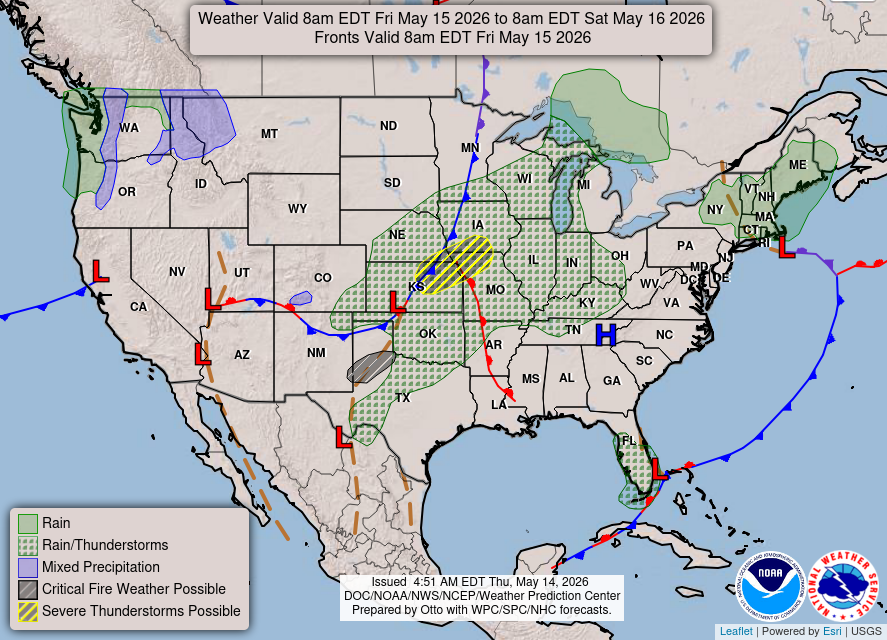
Dry and windy conditions will bring widespread fire weather concerns to the northern/central Plains and portions of the Southwest into the southern Plains. Severe thunderstorms with large hail and damaging wind gusts are possible over the central Plains today into this weekend. Rain and high elevation snow is expected over parts of the Cascades and Northern Intermountain Region through Saturday.
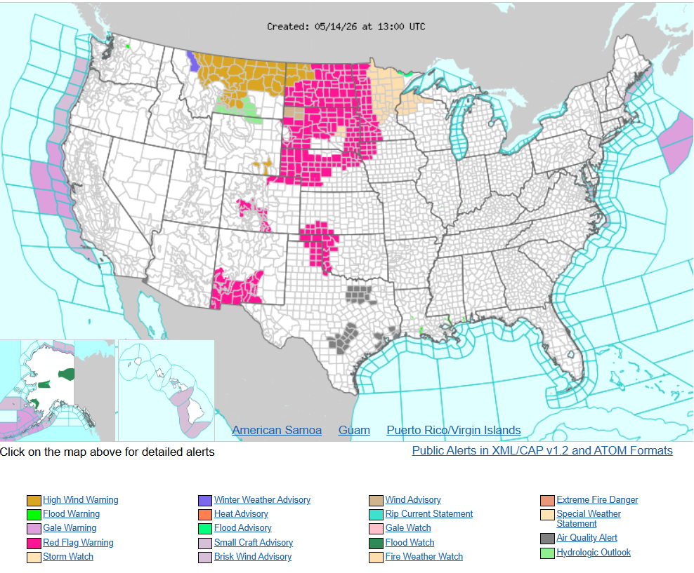
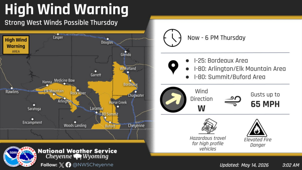
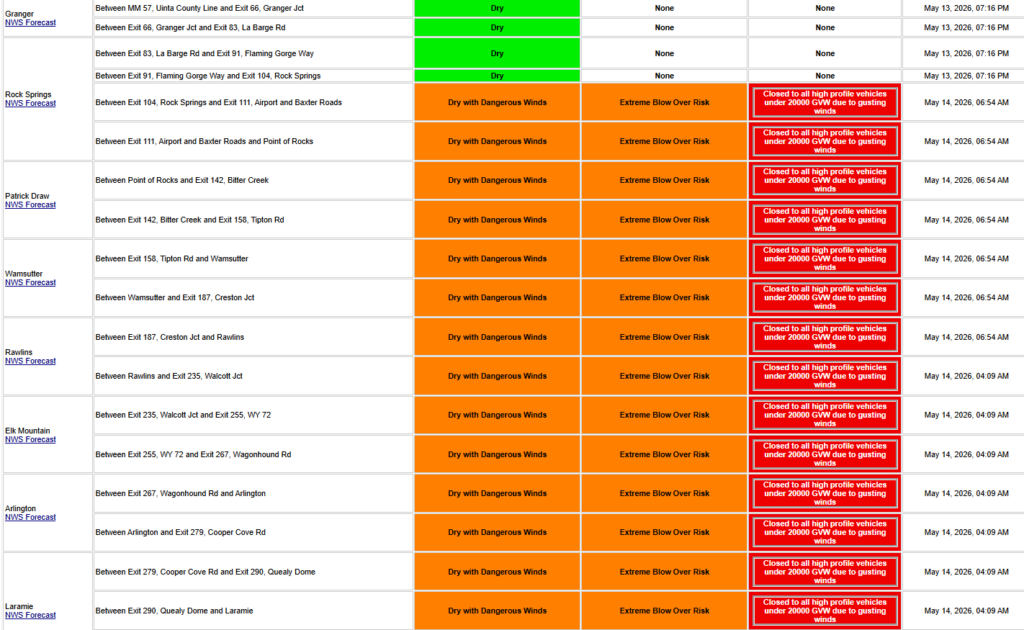
A High Wind Warning is in effect for the typical wind prone regions of southeast Wyoming through 6 PM this evening. Wind gusts up to 65 mph are expected through the morning and afternoon hours. Very dry conditions will lead to elevated fire danger. Use caution if traveling with lightweight or high profile vehicles. Outdoor burning is not recommended.