
Weather Report 3/06/2025
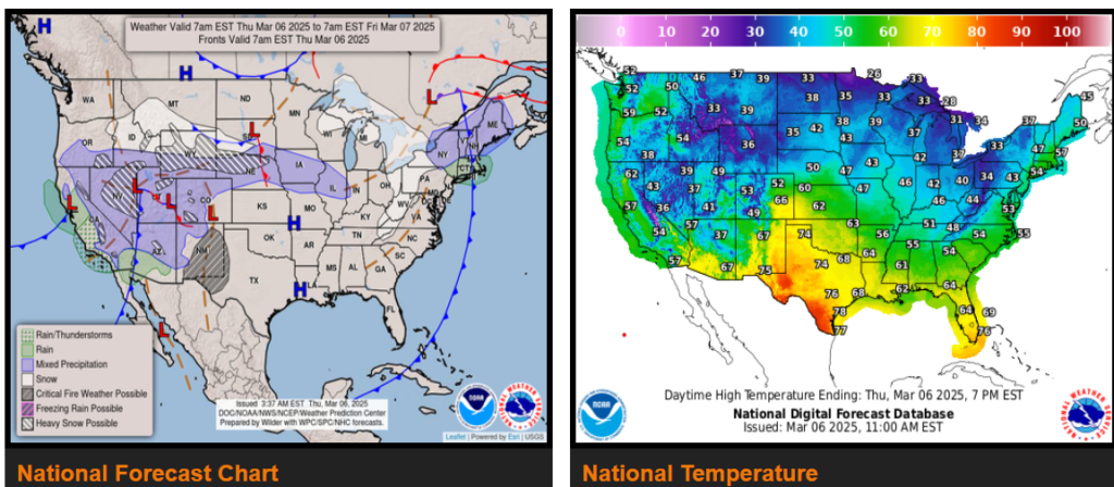
Unsettled weather will continue to impact the Intermountain West, the Rockies, and the Central Plains through the end of the week.
Critical fire weather conditions exist across the southern High Plains.
Colder and drier air to arrive across the East along with some areas of snowfall downwind of the Great Lakes and into the central and northern Appalachians.
A Pacific storm system continues to edge inland across California and this will move advance east across the Intermountain West today and then the Rockies by this evening. While there will be additional areas of lower elevation rainfall, the arrival of colder temperatures with the associated upper-level trough pivoting across the region will set the stage for heavy snowfall across the higher elevations. As much as 1 to 2 feet of new snowfall is expected across the Mogollon Rim of Arizona, the Wasatch of Utah, the high country of western Colorado and also portions of Wyoming as low pressure advances east toward the central Rockies and brings moisture transport and upslope flow to the higher terrain.
Wyoming
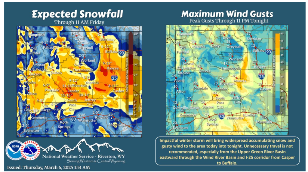
The winter storm is in full force today through tonight. Snow will be heavy at times, especially from the Upper Green River Basin to the I-25 corridor. Gusty wind will reduce visibility at times in that same area. If you must travel be sure to have winter gear and extra supplies.
Safety is our top priority. If you encounter severe weather—whether it’s heavy snow, ice, high winds, or any other hazardous conditions—please don’t risk it. If conditions are unsafe, find a safe place to shut down and wait it out.
Stay safe out there, and thank you for all you do!