
Weather Report 05/23/2025
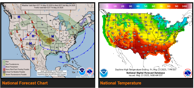
There is a Slight Risk of excessive rainfall over parts of the Central/Southern Plains and the Middle/Lower Mississippi Valley on Friday and Saturday.
There is a Slight Risk of severe thunderstorms over parts of the Central/Southern Plains and the Middle/Lower Mississippi Valleys on Friday and Saturday.
There is a Critical Risk of fire weather over the Southwest on Friday.
Meanwhile, a front extending from the Southern Plains into the Central Rockies and southwestward into the Great Basin will be quasi-stationary through Sunday. Moisture flowing northward out of the Gulf of America will overrun the eastern part of the boundary, creating showers and thunderstorms with heavy rain over parts of the Central/Southern Plains and Middle/Lower Mississippi Valley.
Furthermore, there is a risk of the showers and thunderstorms being severe. Therefore, the SPC has issued a Slight Risk (level 2/5) of severe thunderstorms over parts of the Central/Southern Plains and the Middle/Lower Mississippi Valley through Saturday morning.
Elsewhere, upper-level energy will produce showers and thunderstorms over parts of the Northern/Central Rockies through late Saturday night. In addition, daytime heating will create scattered showers and thunderstorms over parts of the Northern Intermountain Region on Friday and the Great Basin on Saturday.
WYOMING
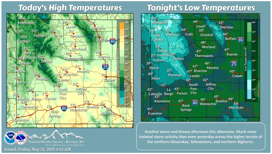
Another warm and breezy afternoon to end the work week. Some isolated storm chances further north and northwest in the higher terrain, but a more widespread chance over the weekend with the next main system pushing in.
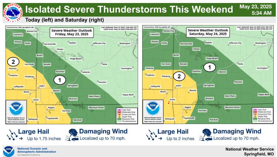
Strong to severe thunderstorms will be possible both tonight and Saturday, with a Slight risk (level 2/5) over the Four Corners region each day. Main threats would be large hail and damaging winds with any severe storms.
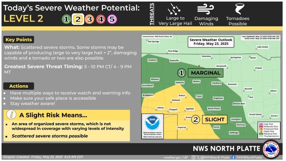
Isolated thunderstorms are expected to form across southeast Wyoming this afternoon, and could move into portions of the Panhandle and southwest Nebraska this evening. These storms would pose a risk for very large hail, damaging winds, and a tornado or two.
Have a good and safe day.