
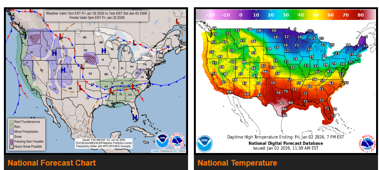
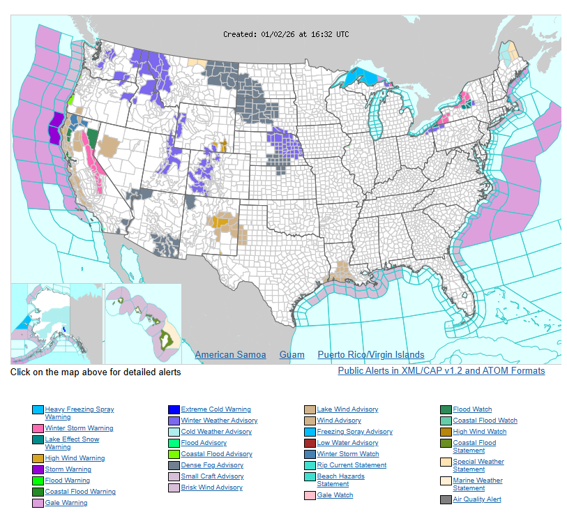
A wet weather pattern returns to the West Coast to begin 2026, while much warmer-than-average temperatures stretch from the Interior West into the Plains and South. Colder-than-normal conditions continue across the Midwest and Northeast, and lake-effect snow remains active near the Great Lakes.
After a brief break, another slow-moving storm system will push Pacific moisture into California, bringing another Atmospheric River event into the weekend. Rain will increase today (Friday) across Northern California, especially along the coastal ranges and Sierra Nevada, then spread south into Southern California on Saturday. There is an isolated risk for flash flooding today, with a higher risk on Saturday north of Los Angeles and in the northern Sierra. Heavier mountain snow will develop in the Sierra and other higher elevations as colder air moves in, lowering snow levels. Gusty winds and some coastal flooding are also possible. Farther north, moderate rain will spread into Oregon and Washington, with snow in the higher elevations of the Cascades.
Lake-effect snow will continue across portions of the Great Lakes, particularly east of Lakes Erie and Ontario, where several inches of snow are expected and localized totals could exceed one foot. Snow will also continue in parts of the Rockies and Great Basin today before tapering off this evening, then increasing again late Saturday in the Northern Rockies as another system approaches. Meanwhile, a fast-moving system will bring showers and thunderstorms to parts of the Southeast on Friday, shifting toward the East and Gulf Coasts by Saturday.
Temperatures will remain well above average across the Interior West and expand into the Plains and South over the next few days. Highs will generally range from the 40s and 50s in the Interior West, the 50s and 60s across the Plains and Southeast, and the 70s and 80s across Texas and along the Gulf Coast, where record highs are possible in eastern Texas. In contrast, much colder air remains locked in across the Midwest and Northeast, with highs mainly in the teens and 20s near the Great Lakes and New England and 30s to 40s farther south. Along the West Coast, temperatures will remain near average, mostly in the 50s and 60s.
WYOMING
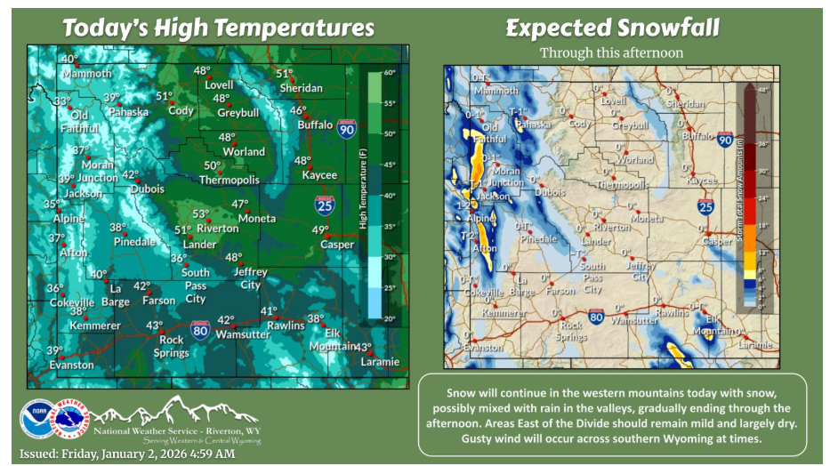
Mountain snow and lower elevation snow mixed with rain continues in western Wyoming, gradually ending in the afternoon. Mainly dry and mild weather should continue East of the Continental Divide.
NEBRASKA
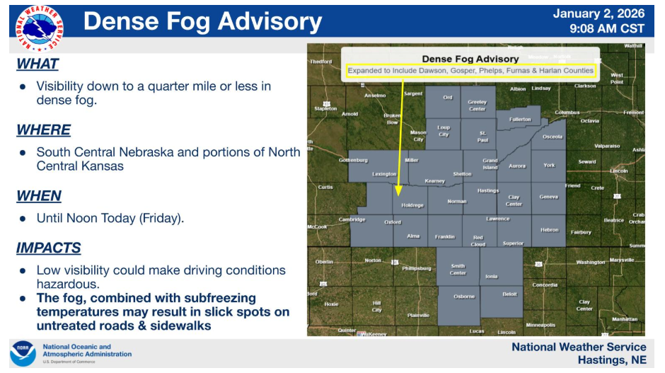
The Dense Fog Advisory has been expanded westward to include a few more counties W/SW of the Tri-Cities. Poor visibility from the fog, combined with subfreezing temperatures, could create some hazardous driving conditions and slick spots on roadways through around noon.
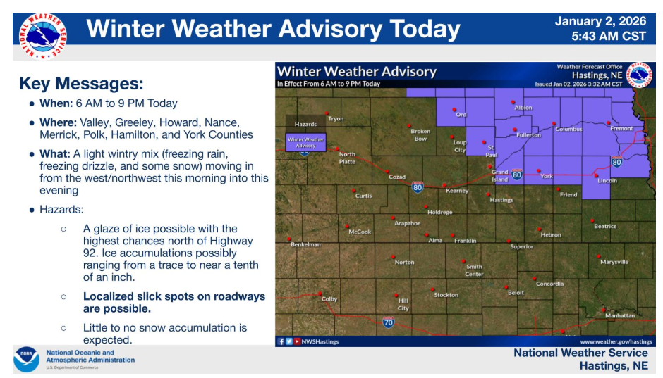
A Winter Weather Advisory is in effect for portions of south central and central Nebraska this morning into this evening. Use caution if driving. Total ice amounts expected to range from around a trace to near a tenth of an inch.
Have a fantastic day.