
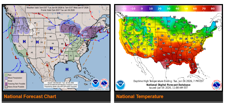
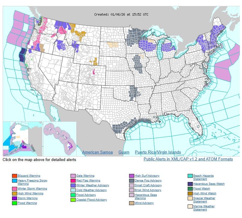
A strong Pacific storm will bring very heavy mountain snow to the Pacific Northwest and parts of the Interior West through mid-week. The Cascades and Olympic Mountains could see multiple feet of snow, while heavy snow also spreads into the northern Rockies and Great Basin. Lower elevations and coastal areas of the Pacific Northwest will see moderate rain, with lighter rain and a possible wintry mix farther inland. The heaviest precipitation is expected today, gradually tapering off by Wednesday into early Thursday.
Farther east, another round of wintry weather will move from the Great Lakes into New England today. Freezing rain is expected from the Upper Great Lakes through portions of Upstate New York and central New England, with ice accumulations up to 0.1–0.2 inches possible. Snow showers will occur just north of this area, especially across interior New England, where the highest snow totals are expected. Light snow may linger into Wednesday for northern New England.
An upper-level system dropping down the West Coast will move east on Wednesday, bringing rain showers to the Desert Southwest. By Wednesday night into Thursday morning, this system will reach the Plains, pulling Gulf moisture northward and creating a growing area of showers and thunderstorms across parts of the southern Plains and Ozarks.
Much warmer than average temperatures will continue across much of the central and eastern U.S. A warming trend will also develop in the Northeast after recent colder conditions. The biggest temperature departures will be across the central and southern Plains into the Mississippi Valley, where highs could run 25 to 40 degrees above average and may approach or break daily records. Cooler conditions will persist along the West Coast, while the Interior West remains slightly above average.
WYOMING
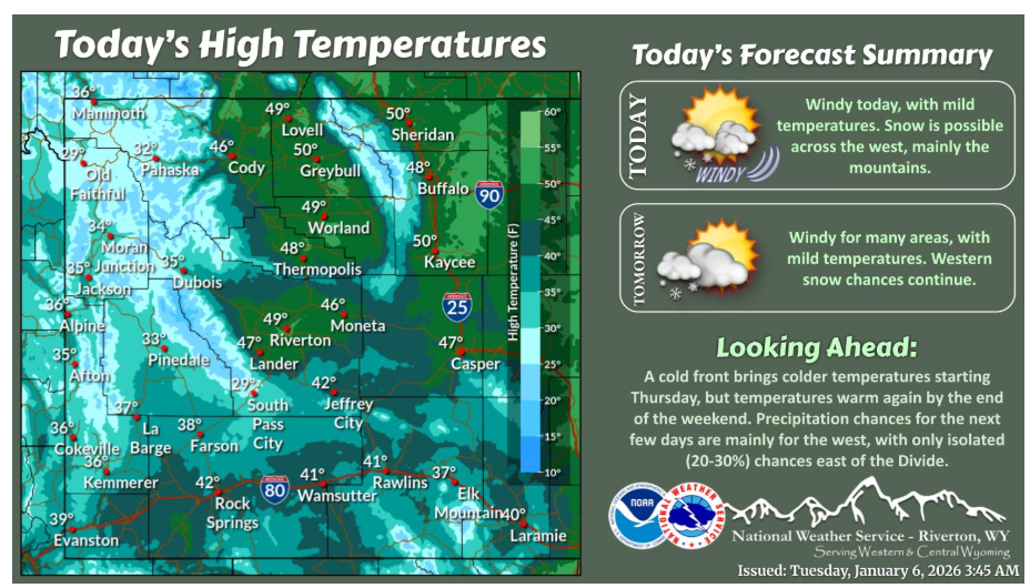
A mild and windy day across a majority of the area. Snow continues across western Wyoming, mainly for the mountains. Similar tomorrow, with a cold front coming Thursday.
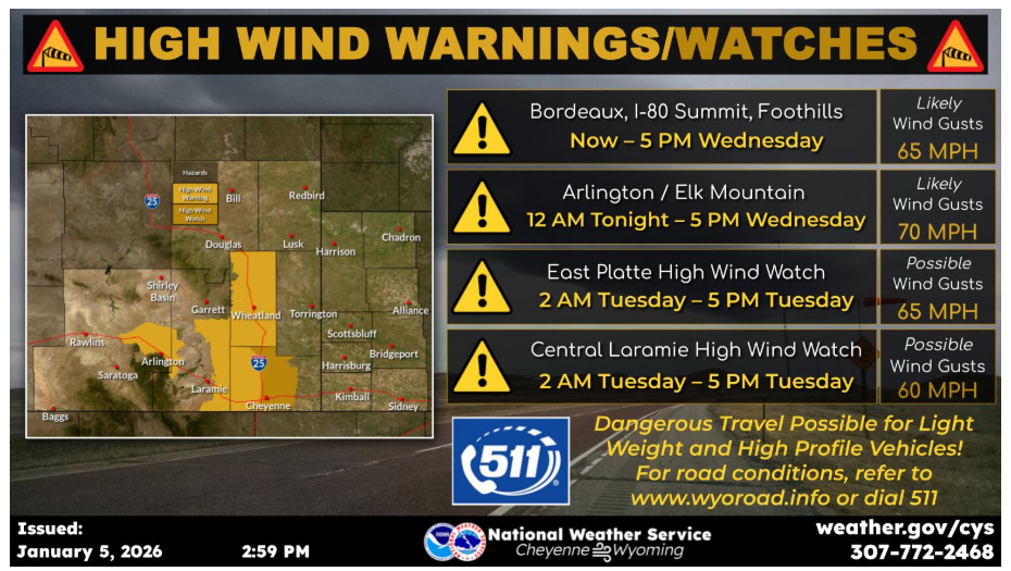
High Wind Warnings will continue through 5 PM Wednesday evening in the typical wind prone areas. High Wind Watches have been issued for eastern Platte County and central Laramie County from 2 AM tonight through 5 PM Tuesday afternoon. Gusts between 65 and 70 mph possible in the warnings, and 60 to 65 mph in the watches. Use caution if traveling with light weight or high profile vehicles.
Have a fantastic day.