
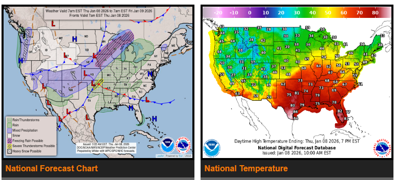
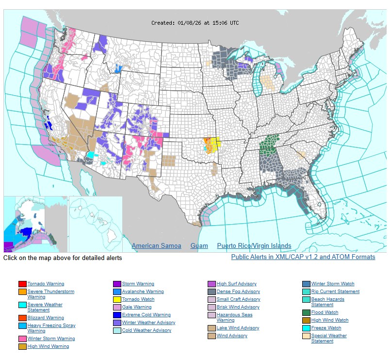
Heavy snow is expected in southeastern Colorado and northern New Mexico from Thursday night into Friday, creating hazardous travel conditions. Additional heavy snow is possible in the Upper Midwest and Great Lakes Friday night into Saturday.
A strong storm system will bring widespread rain, flash flooding, and the potential for severe storms across Oklahoma, the Lower Mississippi Valley, Tennessee Valley, and parts of the Deep South through Friday. Locally heavy rainfall may lead to flooding, and isolated severe thunderstorms are possible.
Meanwhile, unseasonably warm temperatures will continue across much of the Plains, Midwest, Ohio Valley, Southeast, and Mid-Atlantic, with highs running 20–35 degrees above normal. Some areas may see temperatures in the 70s to 80s, which could challenge daily records.
In contrast, the Western U.S. will cool as a cold front moves east, with temperatures falling into the 30s to 50s, running 5–15 degrees below normal. By the weekend, temperatures are expected to return closer to seasonal averages across most of the country.
WYOMING
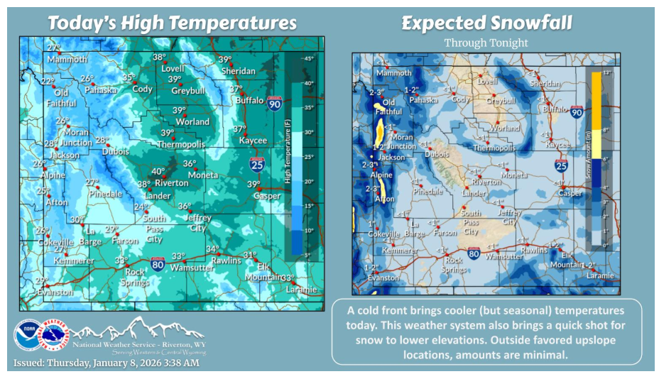
Cooler today with a cold front moving through, though temperatures are still seasonal to above normal. Snow also continues across the west, with some chances for light snow across lower elevations.
Have a fantastic day.