
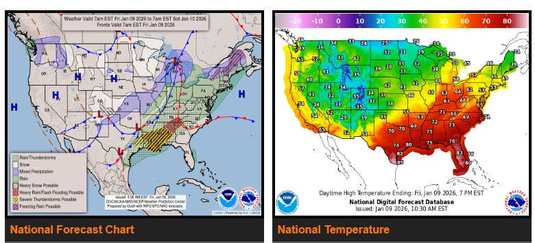
Heavy rainfall and severe weather are expected today across portions of the Lower Mississippi Valley and the Southeast, while heavy snow will impact the Central and Southern High Plains.
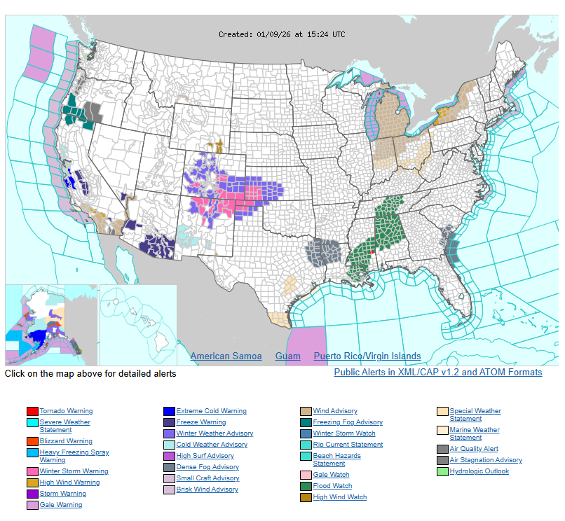
A strong storm system is moving through the central U.S. today. A developing low-pressure system is pulling a cold front south across the High Plains and toward the Ohio Valley. In the Central and Southern High Plains, upslope winds combined with Pacific moisture will produce significant snowfall, with totals of 6 to 8 inches possible. Winter Storm Warnings remain in effect for this region.
Farther south and east, warm and unstable air ahead of the cold front will lead to widespread thunderstorms across the Lower Mississippi Valley and the Southeast. As the front stalls, repeated storms may cause flash flooding, particularly across southern Mississippi and nearby Louisiana, where rainfall totals could reach 5 to 8 inches. Some storms may also become severe, producing strong winds, hail, and a few tornadoes.
By Saturday and Sunday, the front is expected to move into the Mid-Atlantic, bringing widespread rain. Some areas of New England may also see pockets of freezing rain and higher-elevation snowfall with this system.
WYOMING
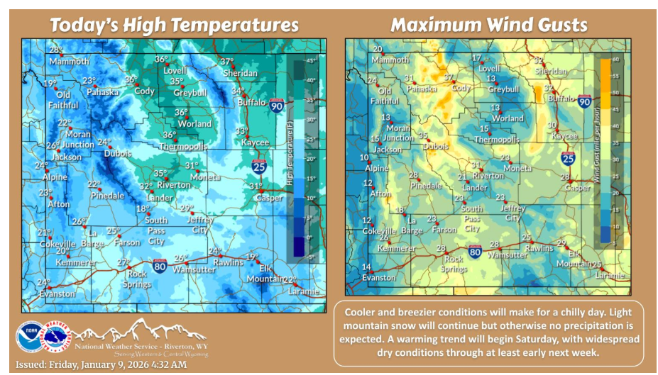
Cooler and breezier conditions will make for a chilly day. Light mountain snow will continue but otherwise no precipitation is expected. A warming trend will begin Saturday, with widespread dry conditions through at least early next week.
Have a fantastic day.