
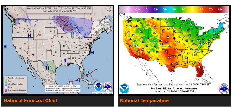
Rapid warm-up expected across much of the Lower 48 today and tomorrow.
High pressure will bring generally calm and dry weather to start the work week. The only notable precipitation will be light rain along the western slopes of the Olympic Mountains from a weakening atmospheric river.
Temperatures will rise well above normal as a zonal jet stream pushes lingering cold air out of the U.S. Most areas will see above-average highs, with the Heartland seeing the biggest warm-up. Highs in the 50s and 60s are expected, which is 25–30 degrees above normal.
The main exception will be along the Gulf Coast, where overnight temperatures could dip near freezing under the center of high pressure.
Colder air is expected to return east of the Continental Divide after Tuesday as several cold fronts move through. A strengthening low pressure system may also bring some wintry weather to the Upper Midwest and Northeast, though impacts through Wednesday morning are expected to be minor.
WYOMING
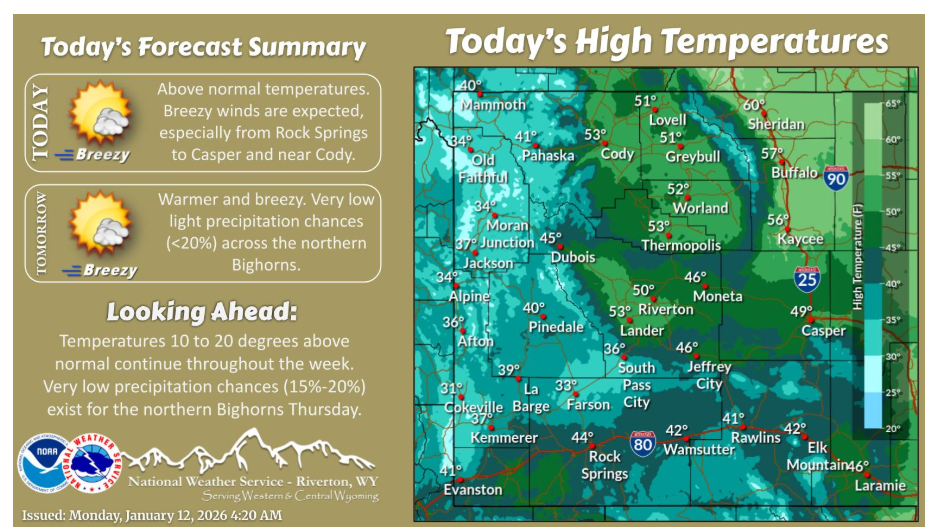
Expect slightly warmer temperatures today with highs 10 to 20 degrees above normal for mid January. Breezy winds are forecast near Cody and from Rock Springs to Casper. A similar day is in store for Tuesday.
Have a nice and safe day.