
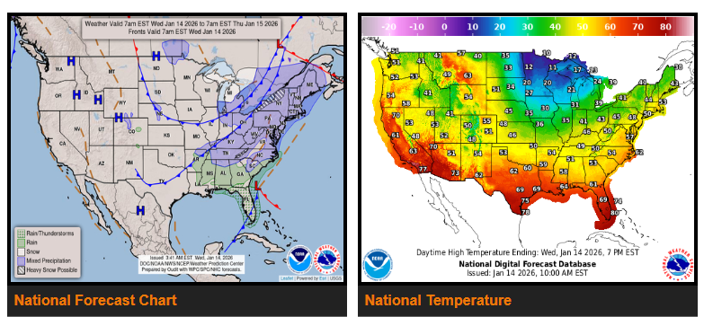
Cold weather returns to the Eastern U.S. today as temperatures drop sharply behind a series of cold fronts moving through the Ohio Valley. Highs will be 10–20 degrees colder by tomorrow under Arctic high pressure, making it feel much more like winter across the region.
Behind the front, strong northwest winds will produce heavy lake-effect snow in the Great Lakes snow belts. The most intense snowfall is expected along the southeast shore of Lake Michigan, where 8–12 inches of snow is possible through Thursday.
Farther east, rain will change to snow across the Ohio Valley and into the Northeast as a low-pressure system develops. Snow will continue through tomorrow, with 3–6 inches expected in many areas and locally higher amounts of 8–10 inches in parts of the Appalachians and northern New York, including the Tug Hill region.
Looking ahead to late Thursday and beyond, another system will move out of the Canadian Prairies into the Northern Plains and Upper Midwest. While snowfall totals appear light at this time, strong winds may lead to blowing and drifting snow. Continue to watch for forecast updates and changing road conditions.
WYOMING
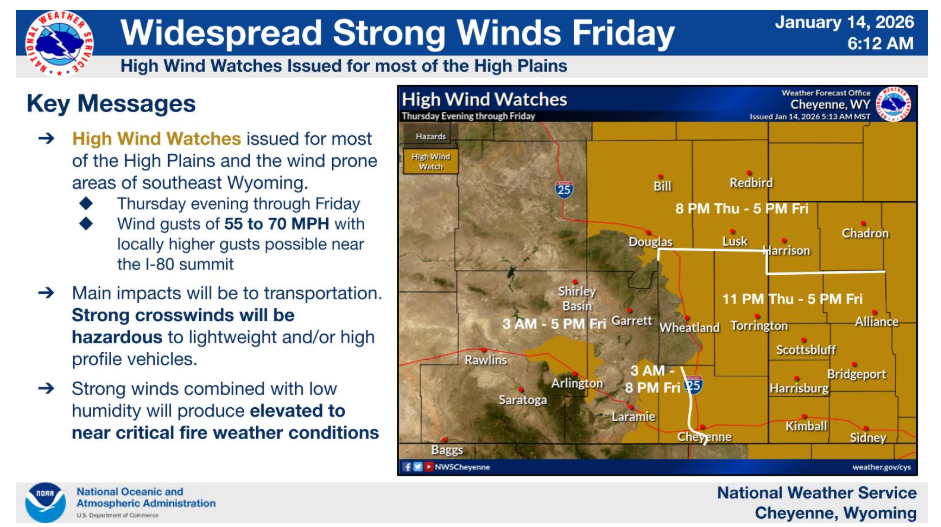
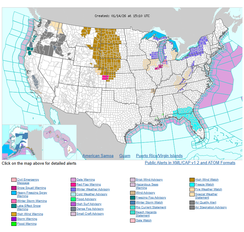
Another round of widespread strong winds is increasingly likely Thursday evening through Friday. Northwest winds gusting 55 to 70 mph are possible mainly along and east of I-25. High Wind Watches have been issued for much of the area. Strong winds combined with low humidity could lead to the rapid spread of grassland wildfire. Outdoor burning is discouraged, especially on Friday when winds are at their strongest.
NEBRASKA
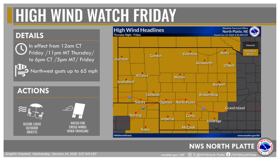
Very strong winds arrive Thursday night through Friday prompting a High Wind Watch to be issued for northwest gusts up to 65 mph. Be prepared for power outages as well as difficulties traveling on Friday.
Have a nice and safe day!