
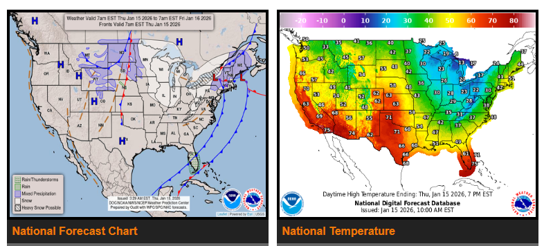
Heavy snow will continue today across parts of the Great Lakes and the interior Northeast, with an additional 6–8 inches possible in areas under Winter Storm and Lake Effect Snow Warnings. Snow should taper off for most locations by this afternoon as the cold front moves east.
Another system dropping in from Canada will bring scattered snow showers to the Upper Midwest and Great Lakes later today. Light accumulations are expected at first, followed by heavier lake-enhanced snow on Friday, especially in northern and western Michigan. As this system moves through late Friday into Saturday, light mixed precipitation may spread from the Midwest into the Northeast and Mid-Atlantic.
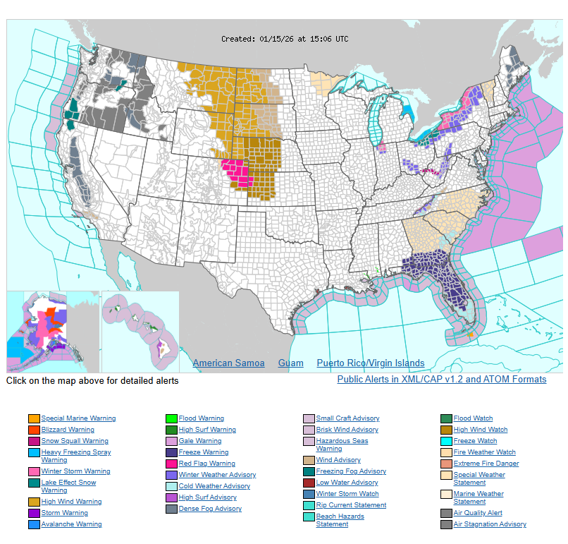
Strong winds will also be a major concern. Much of the northern and central High Plains will see gusty northerly winds today and Friday, with gusts reaching 40–65 mph.
Cold temperatures will persist across much of the eastern U.S. Highs today will generally be in the 20s and 30s from the Great Lakes to the Northeast, and in the 30s and 40s from the Lower Mississippi Valley through the Southeast. Overnight lows will remain below freezing for many areas, including parts of northern and central Florida, where Freeze Warnings remain in effect. Another push of cold air arrives late Friday into Saturday.
Meanwhile, the West will remain much warmer than average. Highs will reach the 50s across much of the Interior West and Pacific Northwest, 60s to 70s in California, and 70s to 80s in the Desert Southwest.
WYOMING
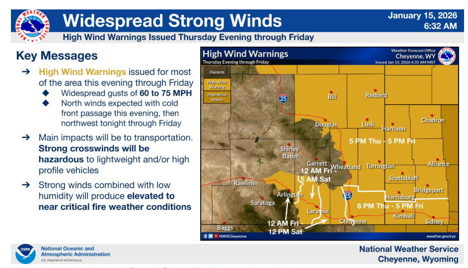
High wind warnings have been issued for much of the area Thursday evening through Friday.
NEBRASKA
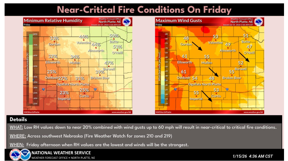
Near critical to critical fire conditions are expected Friday across southwest Nebraska as gusty northwest winds and low RH return to the region.
Have a nice and safe day.