
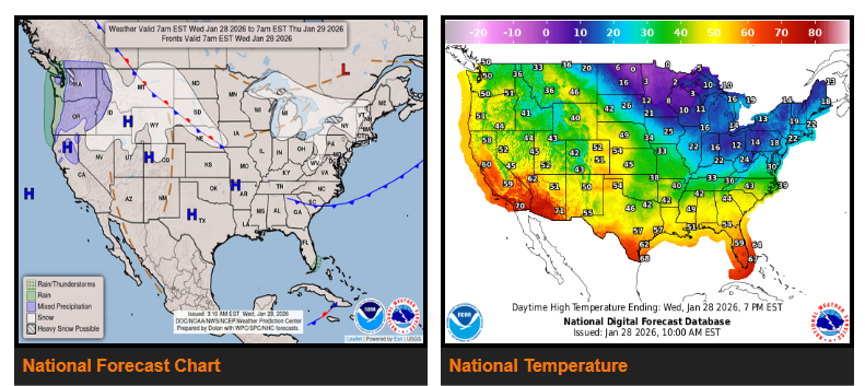
Cold air moving over the Great Lakes will create lake-effect snow in areas downwind through Friday. High pressure moving south out of central Canada will also bring upslope snow to the Northern and Central Plains from Wednesday afternoon through Friday.
Low pressure developing over the Southern Plains will pull moisture north into the Lower Mississippi Valley, producing scattered showers Thursday evening. Weak onshore flow will bring light rain to the southern tip of Florida from Wednesday into Friday.
Out west, onshore Pacific flow will produce coastal rain and higher-elevation snow across the Pacific Northwest through Friday. Light snow will also develop over the Northern Intermountain Region and Northern Rockies starting Wednesday afternoon and continuing into Friday.
WYOMING
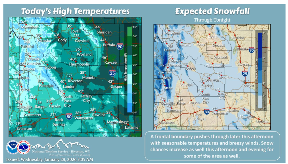
A frontal boundary pushes through today increasing snow chances for some west to east this afternoon and evening. Breezy winds and seasonable temperatures can be had as well with a warming trend the rest of the week and into the weekend.
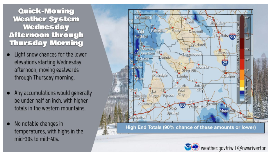
A weak weather system moves in Wednesday afternoon, with light snow chances through Thursday morning. Most places will not see snow, but a dusting to half an inch of snow is at least possible for many lower elevation locations.
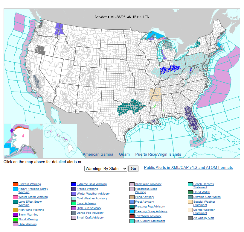
Have a nice and safe day.