
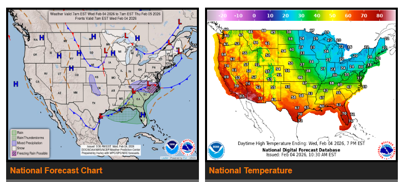
A low pressure system will bring rain and thunderstorms across the South and Southeast today, while light wintry precipitation affects parts of the Mid-Atlantic. Showers and embedded thunderstorms will move from west to east across the Gulf Coast this morning and spread through much of the Southeast into tonight.
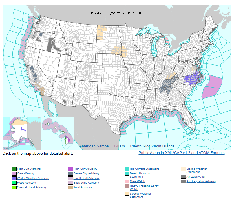
In the Mid-Atlantic, light snow early this morning should taper off by daybreak, but another area of light snow and wintry mix may move across North Carolina later today into tonight as the system slowly passes through the region.
By Thursday, the low pressure wave is expected to move offshore and strengthen rapidly. Showers and thunderstorms will continue ahead of the trailing cold front, especially across the Florida Peninsula. Behind the system, skies will clear across much of the eastern U.S., allowing arctic air to return. Temperatures will fall into the single digits and teens from the Ohio Valley into the Northeast by Thursday morning. By Friday morning, colder air will reach Florida, bringing widespread 30s and 40s, with below-freezing temperatures returning to the Florida Panhandle.
Meanwhile, much of the western U.S. will remain dry and milder than normal. A significant warm-up will develop across the northern High Plains today and expand east into the northern Plains and upper Midwest over the next few days. Light snow will reach the Great Lakes on Thursday, with snow showers and possible snow squalls over the upper Great Lakes early Friday as another strong surge of arctic air arrives from Canada. Farther south across the Great Plains, quieter weather is expected, with gradual warming spreading into Texas by Friday.
WYOMING
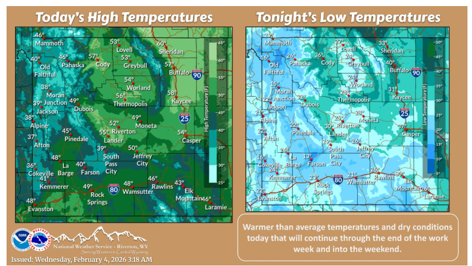
Mainly clear skies and above average temperatures today with dry conditions expected. This will be the story for the remainder of the work week and into the weekend.
Have a nice and safe day.