
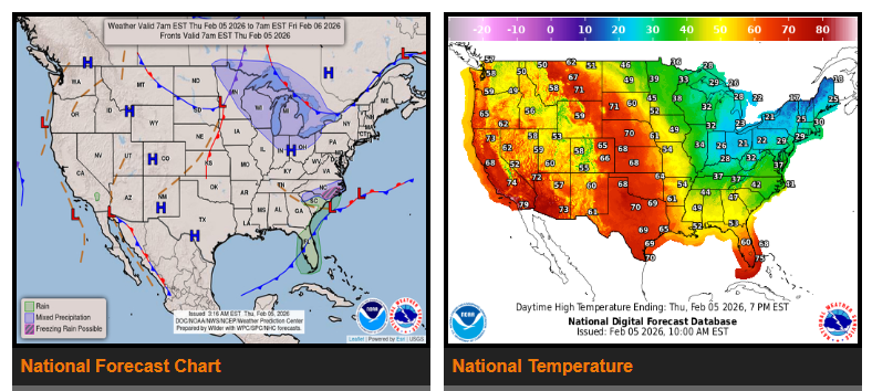
Light wintry precipitation in the Mid-Atlantic and rain with thunderstorms across the Southeast will taper off through the morning. A low-pressure system responsible for this weather is moving off the Southeast coast and will rapidly intensify over the Gulf Stream as it pulls away from the U.S. In Florida, showers and a few embedded thunderstorms will continue today ahead of a cold front before ending this evening.
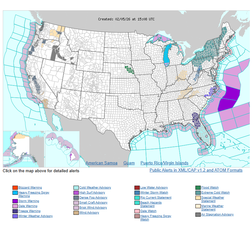
Behind this system, another surge of arctic air will spread across the eastern U.S. By Friday morning, below-freezing temperatures will reach as far south as the Florida Panhandle, before gradually moderating over the weekend.
Meanwhile, a pair of frontal systems will bring periods of light to locally moderate snow to the Great Lakes today and into Friday. An intense arctic front will arrive from Canada late Friday into the weekend, first impacting the upper Great Lakes with snow showers, possible snow squalls, and rapidly falling temperatures.
By Friday night into Saturday morning, the arctic front will push through the Northeast and Mid-Atlantic, bringing snow showers, potential snow squalls, and strong northwest winds. Wind gusts may exceed 50 mph, increasing the risk of tree damage and power outages. Dangerous wind chills in the -30s could pose life-threatening risks of hypothermia and frostbite. Limit time outdoors, cover exposed skin, and take precautions to prevent frozen pipes.
WYOMING
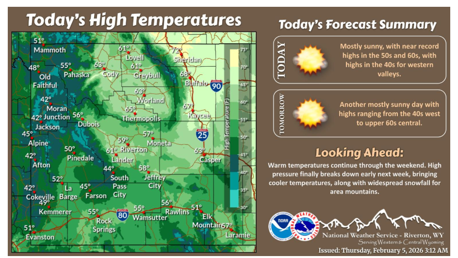
Near record highs east of the Divide today, with highs in the 50s and 60s. Highs in the western valleys will reach the lower to middle 40s. Warm temperatures continue through the upcoming weekend, before another chance for snow for local mountains.
Have a nice and safe day.